
Language
Python
Tool Type
Algorithm
License
The MIT License
Version
0.1.0
Head of Cabinet of Ministers

AEDES Detector is an artificial vision system designed to identify the presence of Aedes Aegypti mosquito eggs in images obtained from ovitraps. This technology is crucial for monitoring and controlling the mosquito population, contributing to the prevention of diseases such as dengue, Zika and chikungunya. Developed in collaboration with the Ministry of Health of Argentina, the Epidemiology area of the City of Buenos Aires and the National Directorate of Data and Public Information, Detector AEDES is supported by image processing algorithms in Python. This system is a key piece in the entomological surveillance strategy, allowing a more agile and effective response to the spread of the mosquito.
The problem addressed by Detector Aedes focuses on the laborious and time-consuming process of manually analyzing images of ovitraps for mosquito surveillance. Traditional methods require entomologists to visually inspect and count mosquito eggs, which can be prone to human error and is not scalable for large-scale monitoring. This solution addresses these challenges by providing an automated, accurate and efficient way to analyze these images, thereby improving the capabilities of mosquito monitoring and control programs.
Computer Vision Algorithms: Employs computer vision algorithms to analyze images from Ovitraps (Ovisensors). Python Package: Available as a Python package, can be installed via pip. Image Processing for Mosquito Detection: Processes images to detect potential mosquito breeding sites. Output to CSV: Capable of saving results to a CSV file for further analysis. Development and Contribution: Offers a development installation option and encourages contributions to improve the software.
Connect with the Development Code team and discover how our carefully curated open source tools can support your institution in Latin America and the Caribbean. Contact us to explore solutions, resolve implementation issues, share reuse successes or present a new tool. Write to [email protected]
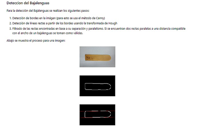
Detection of tongue depressors using Canny and Hough. Showcases edge detection and parallel lines in an image of a tongue depressor on a grey background. Three images illustrate the step-by-step process.
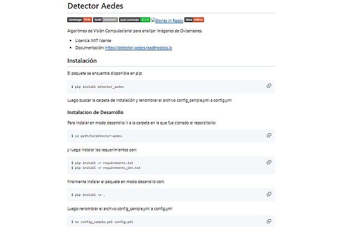
Aedes Detector: Algorithms for ovipositor images. Installation: `pip install detector_aedes` and rename `config_sample.yml` to `config.yml`. Dev installation: clone repo, install req. and rename config. Documentation: detector-aedes.readthedocs.io.
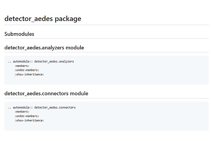
This image shows a Python package documentation snippet with two submodules, analyzers and connectors, using Sphinx directives for autogenerating module information.
Detailed guide on the installation, use and functionalities of the software.
Mention to the development of Detector AEDES in the context of open data projects in Argentina.
Explains the relevance of open source for the Data Argentina team and its featured projects.