
Language
Python
Tool Type
Algorithm
License
GNU General Public License version 3
Version
0.1.0
Fundación Bunge y Born

The Open-air Waste Dump Detection System with AI is a tool that uses artificial intelligence to identify and delimit waste dumps in satellite and aerial images. Using an image classification algorithm, it allows for the analysis of areas at different scales, facilitating solid waste management. This tool focuses on image processing and geolocation, being useful for sectors related to water, sanitation and solid waste. Its ability to work with visual data makes it a valuable resource for improving environmental planning and monitoring in the region.
Taking advantage of the growing availability of open geospatial data, high-resolution satellite images and open source machine learning algorithms, this methodology for automated detection allows analyzing large areas of land to detect garbage dumps, of all scales, helping to identify sites previously unknown by experts and local authorities. The tool makes previously non-existent or difficult-to-access information available to solid waste management at low cost, with high frequency and easily replicable in different areas, allowing quasi-real-time monitoring of the evolution of these sites.
The methodology is described in a brief practical manual, accompanied by Python code notebooks that implement step by step the process of training and applying a neural network model for the detection of open-air dumps.
Integrates multispectral satellite data from Sentinel-2, provided by the European Space Agency, using open formats such as GeoTIFF. Employs open-source geospatial tools like QGIS for analysis and visualization, adhering to Open Geospatial Consortium standards. Incorporates open formats like Shapefile and GeoJSON for geospatial data handling. Utilizes AI frameworks like TensorFlow or PyTorch and programming languages like Python for data processing. Facilitates access to satellite data through open API services such as Copernicus Open
Connect with the Development Code team and discover how our carefully curated open source tools can support your institution in Latin America and the Caribbean. Contact us to explore solutions, resolve implementation issues, share reuse successes or present a new tool. Write to [email protected]
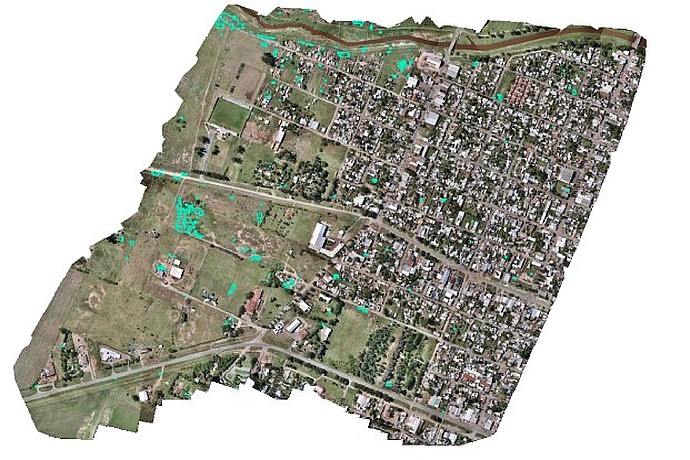
Aerial image of an urban and rural area with green spaces and buildings. Green markers stand out, possibly indicating open-air dumps according to the AI detection system.
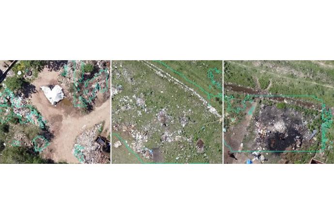
The image shows three aerial views of open-air dumps, with green outlines highlighting areas of scattered waste on dirt and grass terrains.
Project that applies artificial intelligence to satellite images to create a scalable and replicable method for identifying landfills, contributing to environmental management.
Webinar that explores the potential of artificial intelligence for the automated detection of open-air garbage dumps, presented by the IDB.