
Language
Python
Tool Type
API
License
AM331-A3
Version
1.0.0
Inter-American Development Bank

BabelGrid is a Python package that unifies the APIs of geospatial indexing systems such as H3, S2 and QuadTree, allowing the world to be divided into regular grids with unique identifiers and specific properties. This tool makes it easier for researchers and developers to analyze and manage geospatial data through a common interface. BabelGrid provides a comprehensive solution that simplifies the integration of various grid systems, being essential for applications that require fast and efficient processing of geographic information.
BabelGrid solves the difficulty of working with multiple geospatial indexing systems by providing a unified interface. This makes it easier for users to handle complex geospatial data and improves the efficiency of applications that need to quickly load and analyze large volumes of information.
Unified Interface: Provides a common Python API to interact with multiple geospatial indexing systems: H3, S2, and Bing. Geospatial Conversions: Converts between latitude-longitude coordinates and grid-specific addresses/tokens. Transforms between different geospatial data formats, such as WKT, GeoJSON, and Shapely objects. Polyfill Functionality: Fills a given geometry with tiles of a specific grid type and resolution. Tile Descriptions: Access methods to obtain descriptions of tiles in various formats: GeoJSON, WKT, and Shapely. Support for Major Geospatial Indexing Systems: Comprehensive support for S2, H3, and Bing geospatial indexing systems. Integration with Popular Geospatial Libraries: Seamless integration with established geospatial libraries such as Shapely and GeoPandas. Interactive Demonstrations: Jupyter notebooks in the project offer interactive examples and demonstrations of BabelGrid functionalities. Well-Defined Test Cases: Structured test cases, especially for the S2 functionalities, ensure reliability and correctness of the provided features.
Offers a unified Python API that integrates multiple geospatial indexing systems, such as H3, S2, and Bing. Structures its architecture into specialized modules, enabling data conversion and geospatial manipulation. Utilizes open-source libraries like S2Sphere and pygeotile for indexing operations and map tile management. Facilitates organized testing using YAML format data, ensuring accuracy and reliability. Configures its environment through standard files like pyproject.toml and setup.cfg.
Connect with the Development Code team and discover how our carefully curated open source tools can support your institution in Latin America and the Caribbean. Contact us to explore solutions, resolve implementation issues, share reuse successes or present a new tool. Write to [email protected]
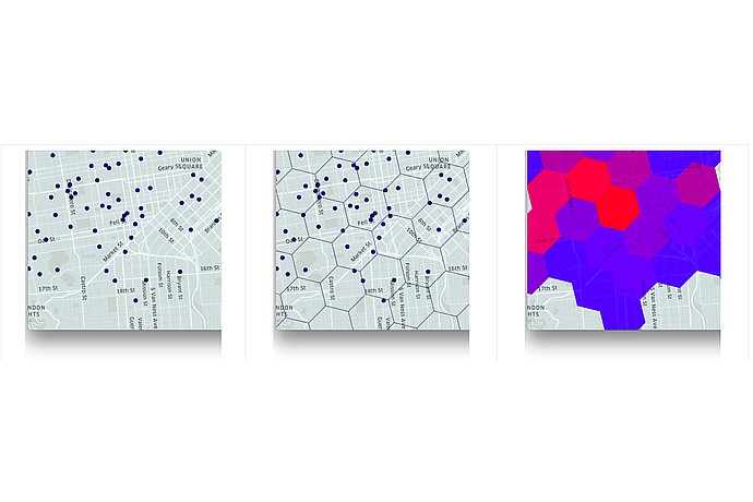
This image displays a series of maps with various overlays, likely representing data points, network distributions, or heatmaps for analysis within an urban area.
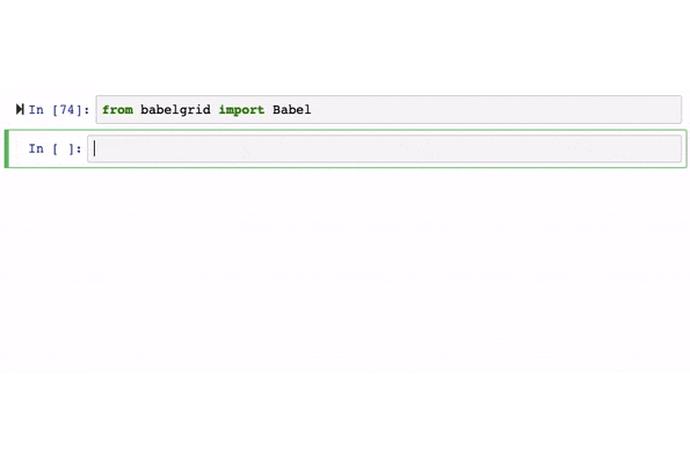
A Jupyter Notebook screen displays a code cell with the instruction: `from babelgrid import Babel`. There are no visible results in the output cell.
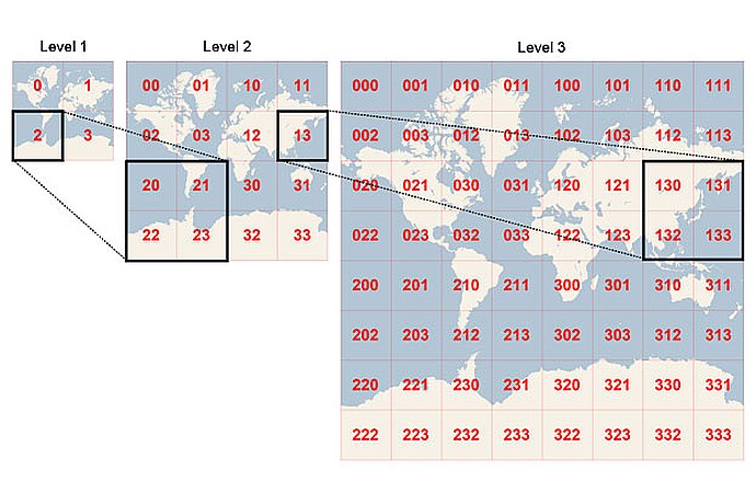
The image shows a three-level grid system of the world: Level 1 with 4 cells (0-3), Level 2 with 16 cells (00-33), and Level 3 with 64 cells (000-333). Each level subdivides the previous one.
Code4Dev Webinar: Get to know BabelGrid