
Language
Python
Tool Type
Algorithm
License
AM331-A3
Version
1.0.0
Inter-American Development Bank

Building Detection uses high-resolution satellite images to automatically identify buildings in urban areas and human settlements. Supports leaders in urban development and housing in the creation of basic building maps, facilitating the planning of unplanned areas and the development of urban services. This machine learning model is trained with images of cities from the IDB Emerging and Sustainable Cities Program, offering an accurate and efficient tool for urban planning and population estimates.
Property Detection solves the need for fast and accurate building mapping tools in urban planning, allowing urban planners and developers to effectively visualize and plan infrastructure, thereby improving data-driven decision making.
AI-Powered Building Identification: The tool employs advanced AI algorithms to detect and classify buildings from satellite and aerial imagery. Urban Planning Insights: Users gain access to detailed information about building density, distribution, and characteristics, aiding urban planning efforts. Data Visualization: "Building Detection" offers visualization tools to create clear and informative maps and reports. Open Data Integration: The platform adheres to open data standards, facilitating the integration of building detection insights with other urban data sources. Sustainability Focus: It supports sustainable urban development by enabling the assessment of urban expansion and its impact on the environment.
Implements data storage on AWS S3, ensuring scalability and security. Utilizes open formats like .Geojson and .tif for geospatial data and images, ensuring interoperability. Stores map data in .mbtiles format, optimizing cartographic information management. Employs .gz compression to enhance storage and transfer efficiency. Deploys with Docker, ensuring consistency across multiple environments. Operates on AWS, leveraging its robust infrastructure. Processes geospatial images with raster vision, organizing data by areas and geographi
Connect with the Development Code team and discover how our carefully curated open source tools can support your institution in Latin America and the Caribbean. Contact us to explore solutions, resolve implementation issues, share reuse successes or present a new tool. Write to [email protected]
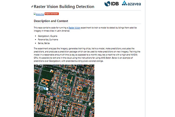
This image shows a page from a "Building Detection" code repository using Raster Vision, focused on three Latin American cities. It includes a visual example of predictions in Georgetown.
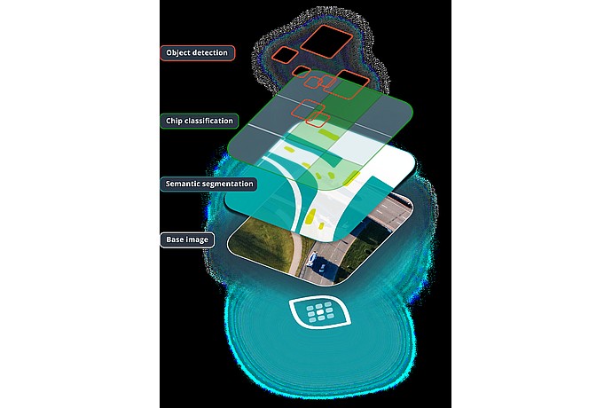
This image illustrates layers of computer vision tasks such as object detection, chip classification, and semantic segmentation over a base image, likely for AI training or analysis.
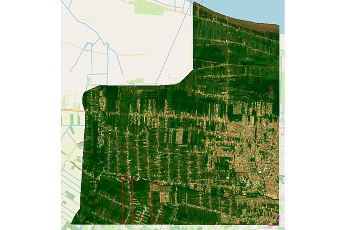
Satellite map with dark green agricultural areas and orange urban zones. Red lines outline two rectangles within green areas in the south of the map. Blue lines indicate watercourses.
Use of AI for automatic classification of buildings.
Urban community mapping in Mexico and Argentina.
Support for housing strategy in Guyana.
Urban projects and programs in Latin America and the Caribbean.
It presents a set of open source tools from the IDB, including housing deficit estimation, to support urban planning in Latin America and the Caribbean.