Language
Python
Tool Type
Mobile app
License
GNU General Public License version 3
Version
0.5.8
CanAirIO

CanAirIO is a scientific project that creates a citizen network to measure air quality using low-cost sensors and mobile technology. The data collected is displayed on a constantly updated map, driving initiatives to improve air quality. Developed to improve the measurement and management of air quality in Bogotá, this project uses new technologies and citizen participation to collect and analyze environmental data, contributing to public health and environmental sustainability.
CanAirIO improves the collection and analysis of air quality data, providing accurate and up-to-date information that allows citizens and authorities to take effective measures to improve the environment.
Mobile app for air quality data visualization. Sensor technology for pollutant measurement. Community engagement for environmental monitoring. Data sharing for public awareness.
Utilizes Python, Java, and C++ to provide a robust and versatile development environment. Integrates applications on Android, facilitating access and interaction with mobile users. Manages and analyzes sensor data, ensuring efficient and accurate processing. Adopts open standards to maximize interoperability and code reuse. Employs open-source technologies, promoting transparency and community collaboration in the tool's continuous development.
Connect with the Development Code team and discover how our carefully curated open source tools can support your institution in Latin America and the Caribbean. Contact us to explore solutions, resolve implementation issues, share reuse successes or present a new tool. Write to [email protected]
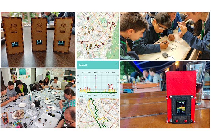
The image shows CanAirIO devices with lit screens, a map with routes and graphs, and people assembling sensors in a workshop. A red portable meter is also visible on a table.
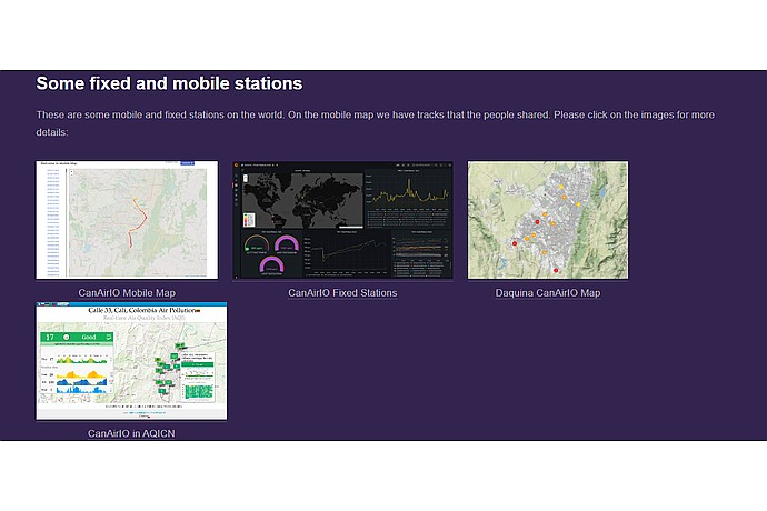
This image displays a collection of maps and data visualizations related to fixed and mobile air quality monitoring stations from CanAirIO project.
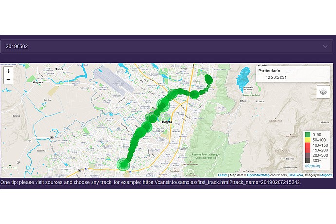
This image depicts a map tracking air quality measurements across a path in Bogotá, indicating levels of particulate matter at various points.
Citizen science project to monitor air quality using mobile and static sensors.
Mobile application to track, view and disseminate air quality data.