
Language
Jupyter Notebook
Tool Type
Desktop app
License
The 2-Clause BSD License
Version
1.0.0
Cider
Cider uses mobile phone data to identify areas of extreme poverty and optimize humanitarian aid. Through an evidence-based approach, this tool allows organizations to direct resources effectively, especially in emergency situations such as famine or natural disasters. By providing a fast, scalable method for targeting aid, Cider significantly improves the efficiency of assistance programs, ensuring that support reaches those who need it most and when they need it most.
Cider addresses the challenge of effectively targeting aid in situations of extreme poverty and emergencies. It uses mobile data to quickly identify needs and optimize the distribution of resources, improving the efficiency and effectiveness of aid programs, especially in critical situations that require rapid and well-targeted interventions.
**Data Anonymization**: Safeguards sensitive information, ensuring privacy and compliance with data protection regulations. **Data Storage Management**: Efficiently organizes and retrieves data, enhancing data accessibility and integrity. **Fairness Assessment**: Ensures unbiased data processing, promoting ethical AI practices. **Machine Learning Facilitation**: Streamlines the development and evaluation of machine learning models, boosting predictive accuracy and performance. **Modular Design**: Offers flexibility and ease of customization to cater to specific business needs.
Built with Python: leverages its versatility and wide adoption in data science. Utilizes object-oriented programming to ensure a structured and scalable codebase. Enhances code maintainability through a modular structure that allows easy integration of new features. Adheres to PEP 8, ensuring readability and consistency. Integrates standard Python libraries to provide robust and efficient functionality.
Connect with the Development Code team and discover how our carefully curated open source tools can support your institution in Latin America and the Caribbean. Contact us to explore solutions, resolve implementation issues, share reuse successes or present a new tool. Write to [email protected]
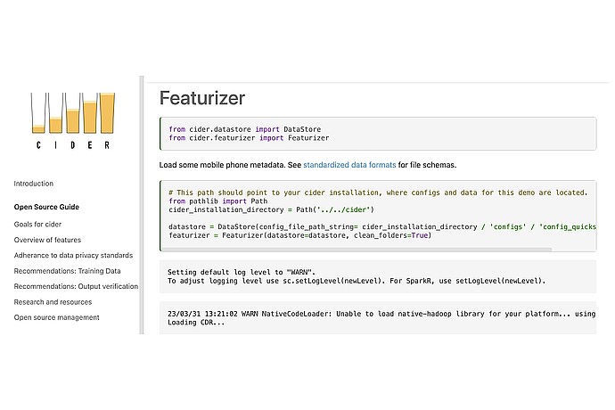
The image shows an example of using "Cider", an open-source tool. "DataStore" and "Featurizer" are imported. It includes a log level adjustment and a warning about Hadoop libraries.
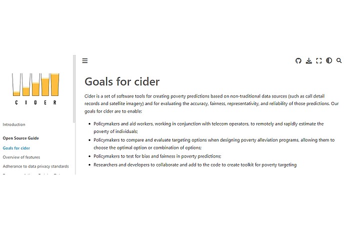
This image is from a webpage for Cider, a software toolset for poverty prediction using alternative data sources, aimed at aiding policymakers and researchers.
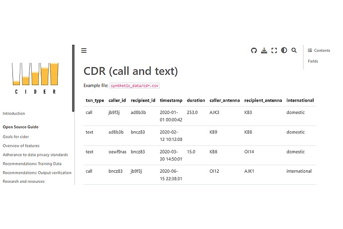
The image shows a CDR data table of calls and texts in "Cider". Columns: transaction type, caller ID, receiver ID, timestamp, duration, caller/receiver antenna, and connection type.
Toolkit developed by UC Berkeley's Global Policy Lab to predict poverty using mobile phone data.
Official list of open source tools endorsed by the Digital Public Goods Alliance. This tool is part of this registry.
Article that presents the global alliance to promote digital public goods and its relationship with the IDB.