
Language
Python
Tool Type
Mobile app, Web app
License
The 3-Clause BSD License
Version
1.0.0
Dimagi

CommCare is a platform that allows non-developers to create mobile applications for data management and decision making in social welfare, including features for low connectivity environments and data security. Used in more than 50 countries, CommCare empowers frontline workers to deliver essential services in communities in need, facilitating the digitization of data and improving the efficiency of health and social projects.
CommCare reduces barriers to accessing essential health services in underserved communities by providing tools that empower frontline workers to improve the quality and efficiency of care.
Customizable Mobile Applications: Enables healthcare workers to collect and access data via tailored mobile apps. Patient Tracking and Management: Facilitates efficient patient registration, follow-up, and health record management. Data Reporting and Analysis: Provides tools for data aggregation, reporting, and insights to guide healthcare decisions. Offline Functionality: Works in low-connectivity environments, crucial for remote area deployment. Scalable and Flexible: Adapts to various health programs and scales from small projects to large-scale deployments. Training and Support: Offers resources
Built on Django (Python) and JavaScript, using Redis, Celery, and SQLAlchemy. Includes strong security practices, Docker containerization, and support for multiple languages.
Connect with the Development Code team and discover how our carefully curated open source tools can support your institution in Latin America and the Caribbean. Contact us to explore solutions, resolve implementation issues, share reuse successes or present a new tool. Write to [email protected]
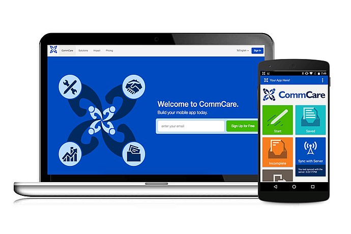
The image shows a laptop and smartphone displaying the "CommCare" tool. The laptop reads "Welcome to CommCare. Build your mobile app today", with sign-in and sign-up options.
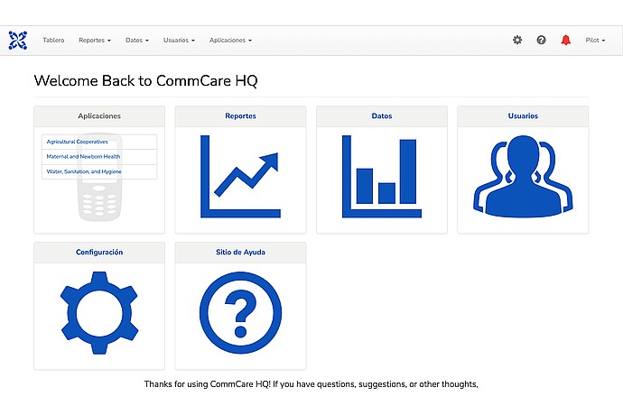
CommCare HQ welcome screen with dropdown menus: Dashboard, Reports, Data, Users, Apps. Large icons for Apps, Reports, Data, Users, Settings, and Help Site.
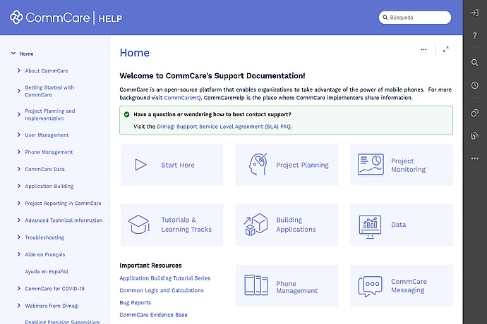
CommCare support page. Sidebar menu with options like "About CommCare" and "User Management". Main buttons: "Start Here", "Project Planning", "Data". Search bar at the top.
Open source digital platform for data collection and program delivery in field work.
Official list of open source tools endorsed by the Digital Public Goods Alliance. This tool is part of this registry.
Article that presents the global alliance to promote digital public goods and its relationship with the IDB.
Mobile application for data collection in the field.