Language
Python
Tool Type
Web app
License
AM331-A3
Version
1.0.0
Inter-American Development Bank

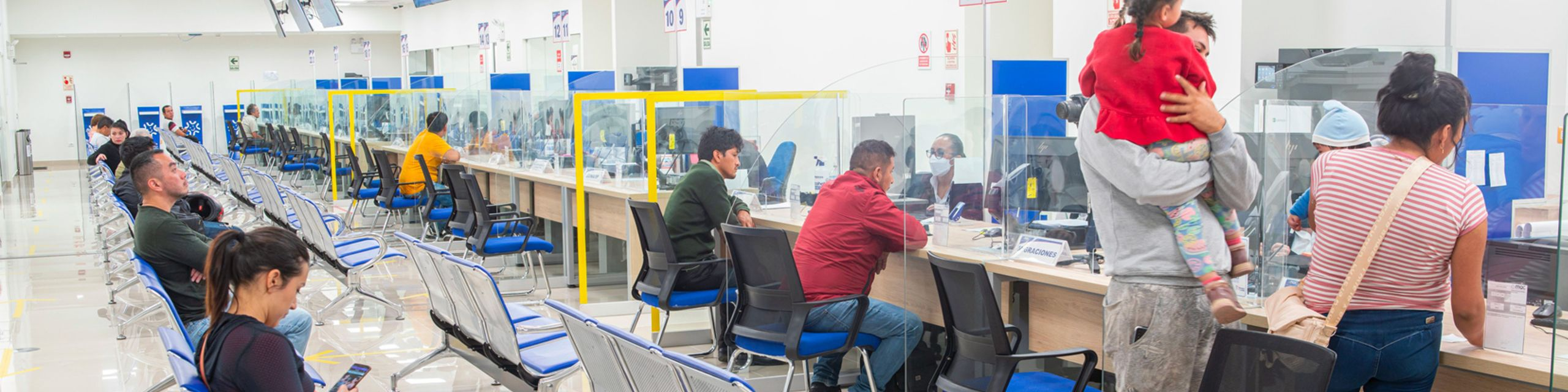
Distancia2 is a platform that uses urban video cameras and AI algorithms to detect people and measure the distance between them in cities in Latin America and the Caribbean. Developed to respond to the COVID-19 pandemic, this tool uses existing video infrastructure to improve public health management by monitoring social distancing, also offering the possibility of adapting the models for specific uses such as detection of use of masks.
Distance2 addresses the critical need to monitor and manage social distancing during pandemics such as COVID-19, using AI technology to analyze compliance in real time and in different environments, essential for the prevention and control of infectious diseases.
Geospatial Analysis: Distancia2 leverages geospatial data to analyze transportation infrastructure, including road networks, public transit systems, and traffic patterns. Route Optimization: The platform offers route optimization tools, helping transportation planners find the most efficient and sustainable routes for infrastructure projects. Environmental Impact Assessment: Users can assess the environmental impact of transportation projects, aiding in compliance with environmental regulations and sustainability goals. Data Integration: Distancia2 can integrate with various data sources, including GIS data, traffic data, and environmental data, providing a comprehensive view of transportation projects. Scenario Planning: Planners can create and evaluate different scenarios to understand the potential outcomes and trade-offs of various infrastructure decisions. Visualization: The platform includes data visualization tools to communicate findings and recommendations effectively. Customization: Distancia2 is highly customizable, allowing government institutions to adapt it to their unique transportation planning needs. Open Source: Being open source encourages collaboration and ongoing development, ensuring that the tool remains adaptable to evolving transportation challenges.
Leverages Python and Tensorflow to enhance artificial intelligence and machine learning capabilities. Utilizes Django as a web framework, ensuring a robust and scalable structure. Employs MySQL for efficient database management. Incorporates NGINX as a web server to optimize performance. Integrates Redis for caching and message handling. Adopts React.js to create interactive user interfaces. Facilitates data visualization with Trama, promoting clear and effective analysis.
Connect with the Development Code team and discover how our carefully curated open source tools can support your institution in Latin America and the Caribbean. Contact us to explore solutions, resolve implementation issues, share reuse successes or present a new tool. Write to [email protected]
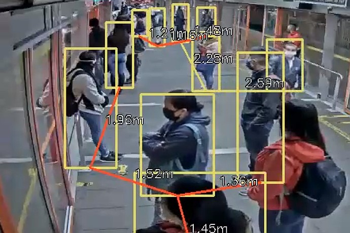
This image appears to show a CCTV feed using facial recognition or tracking technology to identify and measure the distance between individuals in a queue.
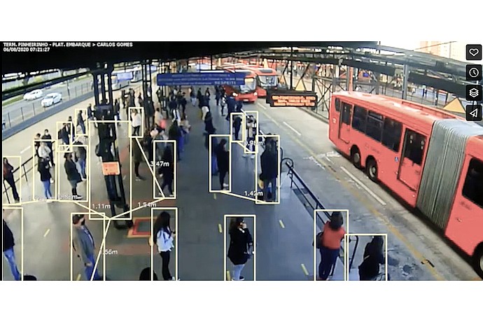
This image shows a surveillance camera feed with automated object detection highlighting individuals and measuring distances between them, possibly for social distancing monitoring.
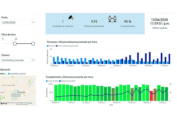
This image shows a dashboard displaying social distancing metrics captured by a camera, with graphs of people count and average distance by hour.
Presents how Distancia2 uses AI to measure the distance between people and avoid infections.
IDB project that supports the development of innovative transportation technologies, including the Distance2 tool.
Details the implementation of Distancia2 in Ecuador's ECU 911 to monitor social distancing.