
Language
Python
Tool Type
Plugin
License
GNU General Public License version 3
Version
1.0.0
LLACTALAB

eMAPS Score QGIS Plugin is a plugin for QGIS that evaluates microscales of pedestrian environments. It uses eMAPS surveys to collect data, configure score calculations, and convert them into passing evaluations, with analysis at the street segment level. Developed to implement the MAPS protocol, this plugin facilitates in-depth urban planning investigations. We share this tool to assist researchers, students and urban planners in the evaluation and planning of more accessible and walkable cities.
eMAPS Score QGIS Plugin solves the complexity of evaluating pedestrian environments at the microscale, providing an accurate tool to collect and analyze urban data, facilitating inclusive urban planning.
eMAPS Score Calculation: Allows users to calculate eMAPS scores based on spatial data. Spatial Analysis Tools: Provides a range of spatial analysis tools to support decision-making. Data Visualization: Enables users to visualize geospatial data and analysis results in QGIS. Export and Reporting: Supports exporting analysis results and generating reports for stakeholders. Customization: Allows users to customize analysis parameters and workflows. Integration: Seamlessly integrates with the QGIS interface for a user-friendly experience. Geospatial Data Support: Works with various geospatial data formats and sources.
Developed as a plugin for QGIS, it leverages this widely used open-source GIS software. Utilizes Python as its main language, ensuring efficiency and flexibility. Employs geospatial analysis libraries like GDAL/OGR and Numpy for advanced operations. Uses QT Framework to create an intuitive graphical user interface. Ensures compatibility with multiple QGIS versions, facilitating adoption. Provides comprehensive documentation for users and developers.
Connect with the Development Code team and discover how our carefully curated open source tools can support your institution in Latin America and the Caribbean. Contact us to explore solutions, resolve implementation issues, share reuse successes or present a new tool. Write to [email protected]
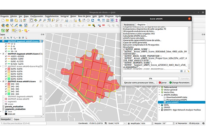
This image shows a GIS (Geographic Information System) software interface, likely QGIS, displaying a map with a color-coded analytical overlay, possibly for urban planning or similar study.
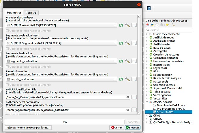
This image displays a GIS interface with a dialog box for an eMAPS scoring tool, showing options for area and segment evaluation and data file inputs.
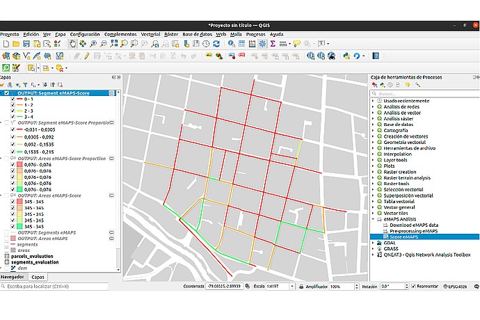
QGIS screen with a street map colored according to "OUTPUT: Segment eMAPS-Score", numeric scales on the left, tools at the top, and "Process Toolbox" on the right.
Description of the tool and its modules.
Detailed manual with installation and methodology.