
Language
R
Tool Type
Web app
License
The MIT License
Version
1.0.0
Epiverse-TRACE
Epiverse TRACE CFR R package is part of the Epiverse initiative, designed to strengthen the global response to public health crises. This specific tool focuses on the collection, analysis and visualization of data, providing essential methodological resources for the effective management of information. By offering a trusted software ecosystem, the Epiverse TRACE CFR R package makes it easy for academics, public officials, and organizations to obtain detailed analyzes from existing data. Its goal is to anticipate and prevent future health crises, fostering a prepared and collaborative community that can generate a positive impact on global health.
Accurate and timely estimation of disease severity and underreporting is a major challenge in epidemiology, especially during outbreaks. Traditional methods often struggle to accommodate real-time data and delays in reporting, leading to potential inaccuracies in assessing the impact of diseases. This problem highlights the need for an advanced analytical tool that can adapt to these dynamic factors.
Real-time estimates of disease severity and under-reporting. Accommodates reporting delays in epidemic time-series. Essential for epidemiological analysis and outbreak response.
Package developed in R as part of the Epiverse-Trace initiative. Licensed under MIT, it's aimed at epidemiological analysis.
Connect with the Development Code team and discover how our carefully curated open source tools can support your institution in Latin America and the Caribbean. Contact us to explore solutions, resolve implementation issues, share reuse successes or present a new tool. Write to [email protected]
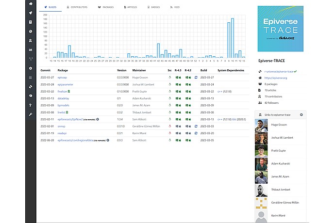
"Epiverse-TRACE" control panel image showing a graph of builds between weeks 13-13, list of package commits with versions, maintainers, dates, and system dependencies; 8 packages and 19 contributors.
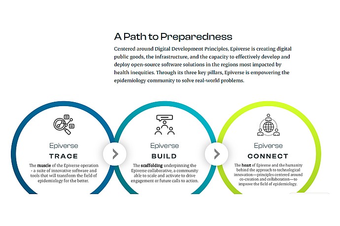
This image outlines Epiverse's approach to preparedness, featuring three key pillars—TRACE, BUILD, and CONNECT—aimed at enhancing epidemiology through innovative software and collaboration.
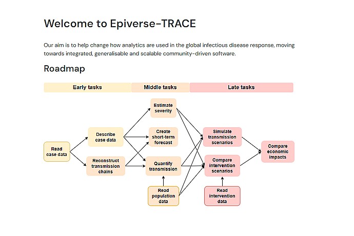
Image of a task scheme for Epiverse-TRACE. Includes: reading and describing case data, reconstructing transmission chains, estimating severity, simulating scenarios, and comparing economic impacts.
Global initiative developing a trusted data analytics ecosystem to anticipate and respond to future public health crises.
Platform that offers outbreak analysis tools and resources for the Epiverse-TRACE community.
Forum where the community proposes and debates new project ideas related to outbreak analysis.