
Language
Java, TypeScript
Tool Type
API, Manual
License
GNU Lesser General Public License version 3
Version
v1.6.1
TerraFrame Inc.

GeoPrism Registry (GPR) is the first implementation of the Common Geo-Registry (CGR) specification. This tool enables efficient management and sharing of geospatial information, facilitating collaboration between different organizations and improving the accessibility of geographic data. GPR is developed by several organizations, including the Health GeoLab Collaborative and Vital Wave. It provides comprehensive documentation and resources for users and developers, as well as a ticketing system for project tracking. Its website offers access to the REST API and installation guides.
Geoprism Registry solves the problem of geospatial data management and standardization in governments and organizations. It facilitates the integration and access to accurate and up-to-date geographic information, improving decision-making and coordination among different entities in Latin America and the Caribbean.
Geoprism Registry operates as an implementation of the Common Geo-Registry (CGR) that allows users to efficiently manage and share geospatial data. It facilitates the integration of geographic information into healthcare systems and other sectors, improving decision-making through accurate and up-to-date data.
The Geoprism Registry tool uses the open standard Common Geo-Registry (CGR) specification, which facilitates interoperability and the exchange of geospatial data between different systems and organizations.
Connect with the Development Code team and discover how our carefully curated open source tools can support your institution in Latin America and the Caribbean. Contact us to explore solutions, resolve implementation issues, share reuse successes or present a new tool. Write to [email protected]
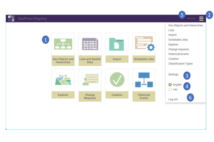
Main view of GeoPrism Registry showing access to geo-objects, data import, scheduled jobs, and change requests.
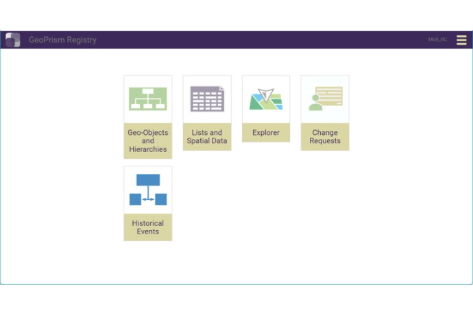
Main GeoPrism Registry menu with quick access to geo-objects, spatial data, explorer, change requests, and historical events.
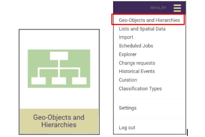
The Geo-Objects and Hierarchies module can be opened from the main panel icon or the dropdown menu.
Official list of open source tools endorsed by the Digital Public Goods Alliance. This tool is part of this registry.
Article presenting the global alliance to promote digital public goods and its relationship with the IDB.