Language
TypeScript
Tool Type
Web app
License
The MIT License
Version
v2.9.2
Technologiestiftung Berlin

Giess den Kiez is a tool that allows citizens and officials to coordinate the watering and care of urban trees in Berlin. Launched in May 2020, the app visualizes more than 840,000 trees on an interactive map, providing information about each species, its age, and water needs. The main goal is to prevent tree drought and connect volunteer communities. Since its inception, more than 3,200 people have participated, watering more than 10,000 trees with over 1,600,000 liters of water, thus raising awareness about the importance of urban trees.
Giesselden Kiez solves the problem of water stress in urban trees in Berlin, caused by climate change, by coordinating community watering. The tool allows citizens and officials to adopt and care for trees, promoting citizen participation and easing the workload of local authorities.
Giess den Kiez is a web application that allows citizens and officials to coordinate urban tree watering in Berlin. It uses an interactive map with open data to visualize over 840,000 trees, allowing users to adopt and water trees, helping to mitigate the effects of climate change.
Giesselsden Kiez uses open standards by being built entirely on open-source code and using only open data. This includes Berlin's urban tree data and crowdsourced citizen data, promoting transparency and collaboration in urban tree care.

Connect with the Development Code team and discover how our carefully curated open source tools can support your institution in Latin America and the Caribbean. Contact us to explore solutions, resolve implementation issues, share reuse successes or present a new tool. Write to [email protected]

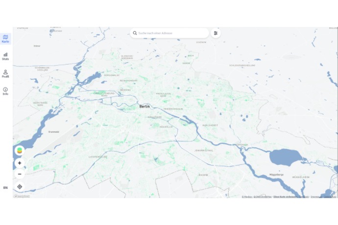
Displays Berlin’s trees on an interactive map where users can search addresses, explore data, and engage in community watering.

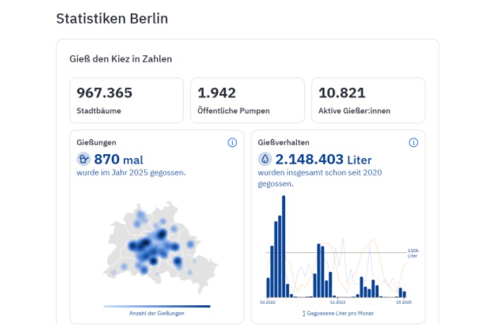
Displays total trees, public pumps, and active users, along with historical watering data and liters of water used since 2020.

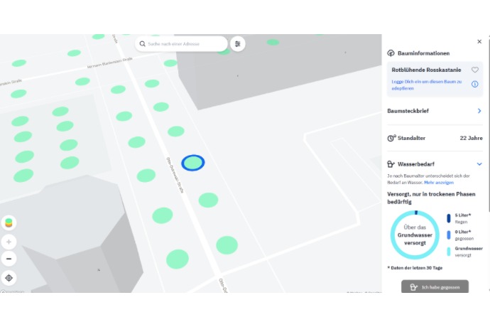
Displays details of a specific tree, including species, age, and water needs, allowing users to adopt and log watering actions.
Interactive map to “adopt” trees, register and plan irrigation.
Datasets and documentation for exploring and downloading tree data.
Candidate for the Public Sector Free Software Awards.
