
Language
R
Tool Type
Algorithm
License
GNU General Public License version 3
Version
1.0.0
Rodrigo Azuero
GmapsDistance is a library designed to facilitate the calculation of distances between multiple origin and destination points, using the Google Maps infrastructure. It allows users to specify different modes of transportation, such as walking, cycling, driving or public transportation, and consider variables such as traffic at different times of the day. This tool, created by Rodrigo Azuero, has proven its usefulness in various studies and practical applications. From evaluating accessibility to health services and public transportation to analyzing the impact of distance on property valuations and the health of specific populations. GmapsDistance stands out for its ability to handle large volumes of data, offering effective solutions for urban planning and decision making based on geolocation.
The problem that "Gmapsdistance" addresses is the complexity of accurate distance calculations in various applications. Calculating distances between two points on the Earth's surface involves complex spherical geometry and geocoding to convert addresses into coordinates. These calculations are essential for applications such as route optimization, location-based marketing, and real-time tracking. "Gmapsdistance" simplifies this process by providing an easy-to-use interface for distance calculations, saving developers time and effort.
Geocoding Integration: Utilizes Google Maps Geocoding API to convert addresses to coordinates. Distance Calculation: Computes distances between two points, whether in miles, kilometers, or other units. Route Optimization: Supports route planning by calculating distances along multiple waypoints. Batch Processing: Allows for the bulk calculation of distances between multiple sets of points. API Access: Provides a straightforward API for programmatic distance calculations. User-Friendly Interface: Offers a user-friendly web-based interface for manual calculations. Geographical Boundaries: Enforces geographical constraints for calculations within specified regions or areas.
Built with Python and JavaScript, it leverages the Google Maps Geocoding API to convert addresses into coordinates. Utilizes JSON and CSV data formats for interoperability. Ensures secure handling of location data and API keys. Designed to scale and efficiently handle a high volume of distance calculations. Provides clear documentation for users and developers. Complies with Google Maps licensing and terms of use, and implements detailed error handling.
Connect with the Development Code team and discover how our carefully curated open source tools can support your institution in Latin America and the Caribbean. Contact us to explore solutions, resolve implementation issues, share reuse successes or present a new tool. Write to [email protected]
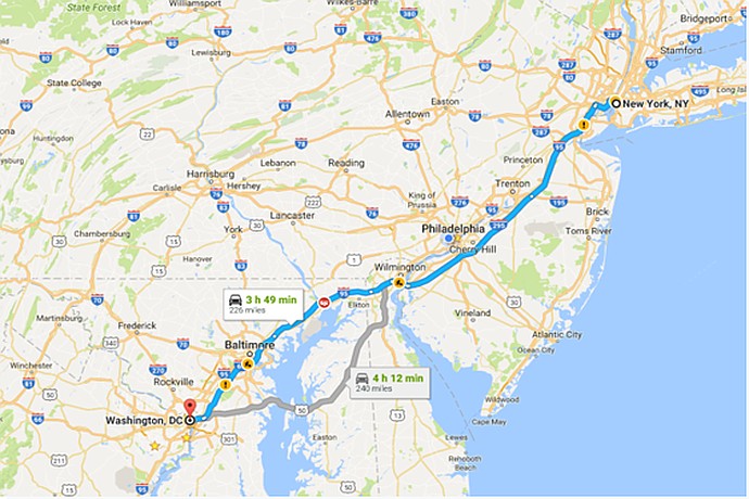
Road map from New York, NY to Washington, DC by car. Main route takes 3h49m covering 229 miles. Another option takes 4h12m. Route goes through Philadelphia, Baltimore, and Wilmington.
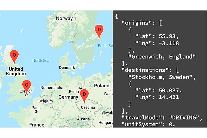
Map with markers in the UK, Germany, and Sweden. JSON text: origin at 55.93, -3.118; destination at 50.087, 14.421. Mode: "DRIVING", unit system: 0. Includes places like London and Stockholm.
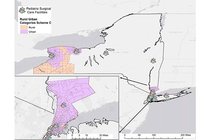
Gmapsdistance has been used in different areas, so this image depicts a map highlighting pediatric surgical care facilities in rural and urban areas in parts of New York.
Detailed explanation of the functionality of GmapsDistance and its application in public policy projects.
Hands-on tutorial on how to use GmapsDistance to query the Google Maps API from R.
Official manual for the GmapsDistance package in CRAN, including details on its installation and use.