Language
Javascript, Python
Tool Type
Desktop app, Web app, Mobile app
License
GNU Affero General Public License 3
Version
N/D
gvSIG Association

gvSIG Suite is a geospatial information platform designed to offer Geographic Information Systems (GIS) solutions. It includes gvSIG Desktop for geospatial data management, gvSIG Online for creating geoportals, and gvSIG Mapps for developing mobile applications. Its use extends to areas such as agriculture, the environment, and infrastructure. The gvSIG Suite allows organizations to customize their spatial data management capabilities. It offers tools for data capture, spatial analysis, interactive visualization, and information integration. It also facilitates project collaboration, improving location-based decision-making.
The gvSIG Suite solves the problem of managing and analyzing geospatial data in an efficient and customized manner. It offers advanced tools for capturing, analyzing, and visualizing geospatial information, facilitating informed decision-making in sectors such as agriculture, the environment, and infrastructure, and adapting to the specific needs of each organization.
The gvSIG Suite is an open-source platform that facilitates the management of geospatial information through three products: gvSIG Desktop for advanced data management, gvSIG Online for creating spatial data infrastructures, and gvSIG Mapps for developing mobile applications. Its flexibility allows for customization and expansion of capabilities based on specific needs, improving decision-making in sectors such as agriculture, the environment, and infrastructure.
The gvSIG Suite uses open standards such as OGC (Open Geospatial Consortium) to ensure interoperability and compatibility with other geospatial systems. This allows users to efficiently integrate and share data, facilitating collaboration and analysis on projects that require accurate and up-to-date geospatial information.

Connect with the Development Code team and discover how our carefully curated open source tools can support your institution in Latin America and the Caribbean. Contact us to explore solutions, resolve implementation issues, share reuse successes or present a new tool. Write to [email protected]

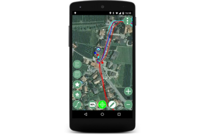
The gvSIG Mobile app allows precise GPS tracking over satellite maps, even in offline rural areas.

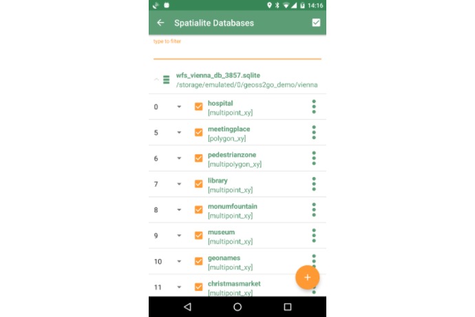
View and select spatial layers from SpatiaLite databases directly on your mobile device.

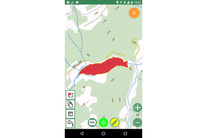
View topographic maps and edit geospatial polygons directly from your mobile device.
Desktop, extensible, multi-format GIS client.
Desktop, extensible, multi-format GIS client.
Quick start guide to gvSIG Desktop.
Overview of the gvSIG suite as an open GIS platform.
Candidate for the Public Sector Free Software Awards.
