
Language
R
Tool Type
Web app
License
AM331-A3
Version
1.0.0
Inter-American Development Bank

IPTU Active Debt Profile is a tool designed to evaluate the stock of IPTU active debt in municipalities, profiling debtors by integrating municipal data with external databases, such as the 2010 IBGE Census. This application provides a detailed and updated view of debts, allowing more effective management of municipal resources. Developed under Technical Cooperation BR-T1496, this tool seeks to demonstrate how the appropriate visualization of internal and external data can improve municipal decision making. By combining relevant information, the "IPTU Active Debt Profile" supports the formulation of strategies to optimize tax collection, thus contributing to citizen well-being and efficiency in the provision of public services.
The IPTU Active Debt Profile tool solves the problem of managing the stock of IPTU active debt in municipalities, offering a detailed profile of debtors by integrating municipal data with external sources. This allows for more effective municipal resource management and optimized tax collection, improving service delivery and citizen well-being.
Debt Management: The platform often includes tools for managing and tracking property tax debts, including details of individual properties and their owners. Data Analysis: It supports data analysis, enabling users to gain insights into debt trends and collection efforts. Reporting: Users can often generate comprehensive reports and visualizations to aid in decision-making.
Includes customizable code and data preparation guidelines for local environments. Compatible with ODBC, especially MS SQL Server, and designed for server-based automated visualization.
Connect with the Development Code team and discover how our carefully curated open source tools can support your institution in Latin America and the Caribbean. Contact us to explore solutions, resolve implementation issues, share reuse successes or present a new tool. Write to [email protected]
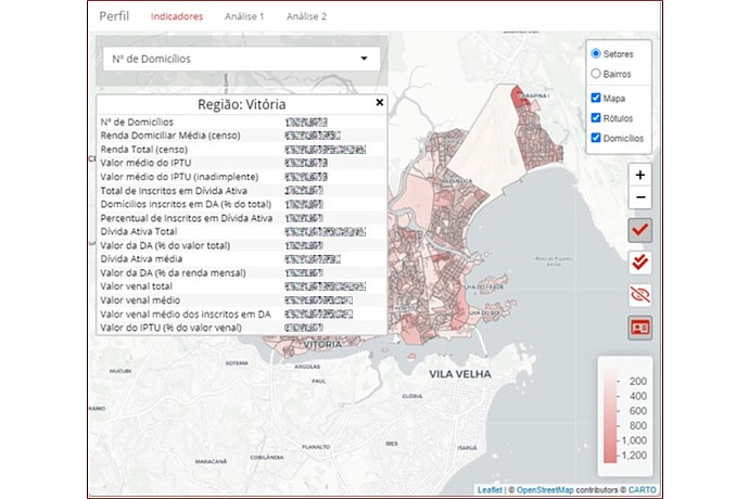
Interactive map of Victoria with data: number of households, household income, average IPTU value, homes in active debt, and related percentages. List and navigation options on the right.
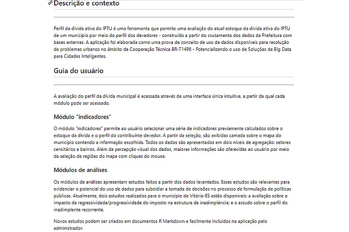
This image displays a Portuguese text describing a tool for analyzing property tax debt profiles and a guide for users on how to access modules and indicators.
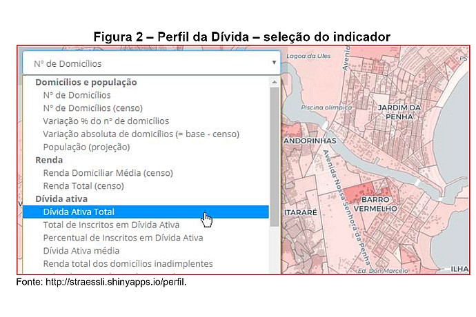
This image shows a screenshot of a data visualization interface for debt profiling with an indicator selection menu, alongside a geographical map for context.
The "IPTU Active Debt Profile" is a tool that allows a current evaluation of the stock of the active division of IPTU of a municipality through the profile of the debtors, built from the crossing of data from the Prefeitura with external bases. An application developed as a proof of concept for the use of available data for the resolution of urban problems in the field of Technical Cooperation BR-T1496 - Potentializing the use of Big Data Solutions for Smart Cities.
IDB Technical Cooperation to support Brazilian cities with data-based tools.