
Language
Javascript
Tool Type
Web app, Mobile app
License
The MIT License
Version
1.0.0
Kwantu platform
The Kwantu Platform is a low-code solution that allows users to create and maintain integrated data applications without advanced programming knowledge. This platform is used in productive environments to monitor the execution of important government and NGO programs, optimizing the management and monitoring of these projects. Developed to innovate in service delivery, the Kwantu Platform shares lessons learned and expertise on specific issues, improving collaboration. In addition, its mobile resources and capabilities to increase citizen participation in services strengthen commitment and effectiveness in program execution.
The Kwantu Platform resolves the complexity in planning, information exchange and decision making in projects in the health sector and other areas, facilitating more efficient management and a more significant impact on the communities served.
Data collection and aggregation from various sources. Efficient data storage and retrieval systems. Advanced data processing and analysis tools. User-friendly interface for data visualization and reporting. Scalability to handle large volumes of data. Security features to protect sensitive data.
Built with modern programming languages, it incorporates Python, Java, and JavaScript to maximize efficiency. Utilizes SQL and NoSQL databases to ensure flexible and scalable data storage. Employs data processing frameworks like Apache Hadoop and Spark to handle large volumes of information. Integrates advanced data visualization tools to effectively graphically represent information. Adopts secure web technologies, ensuring compliance with security and data privacy regulations.
Connect with the Development Code team and discover how our carefully curated open source tools can support your institution in Latin America and the Caribbean. Contact us to explore solutions, resolve implementation issues, share reuse successes or present a new tool. Write to [email protected]
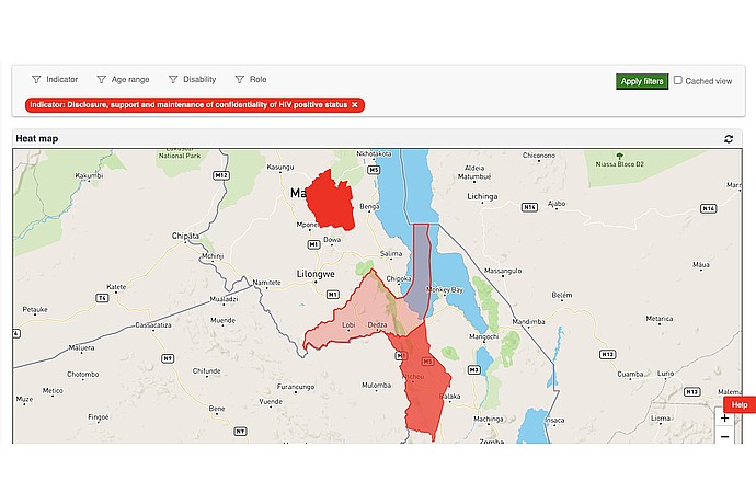
Heatmap showing areas in Malawi and Zambia regarding HIV status confidentiality. Red regions highlight levels of disclosure, support, and confidentiality maintenance.
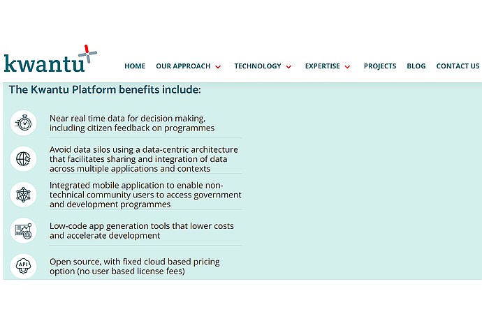
This image summarizes the benefits of the Kwantu Platform, emphasizing real-time data for decision-making, integrated mobile access, low-code development tools, and open-source availability.
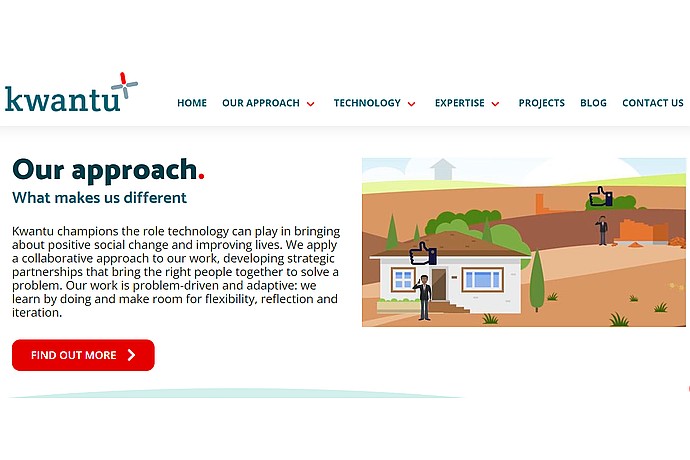
This image showcases the Kwantu platform's unique approach, emphasizing technology's role in social change, collaborative work, strategic partnerships, and adaptable problem-solving methodologies.
Low-code platform to build and maintain advanced data applications without programming.
Official list of open source tools endorsed by the Digital Public Goods Alliance. This tool is part of this registry.
Article that presents the global alliance to promote digital public goods and its relationship with the IDB.