
Language
Javascript
Tool Type
Desktop app, Mobile app
License
GNU General Public License version 3
Version
5.6.2
Digital democracy

Mapeo is a mobile and desktop mapping tool designed to document environmental and human rights information, ideal for use in remote and offline areas. It allows users to collect evidence in the field, such as photographs and GPS points, and organize this data for actions such as whistleblowing and claiming land rights. Mapping is essential for communities facing threats such as illegal extraction or rights violations.
Mapping offers a robust and accessible solution for documenting and managing critical information in remote regions, allowing vulnerable communities to record and report environmental and human rights violations without the need for constant connectivity.
Offline Mapping: Enables users to collect and edit geographic data in offline or low-connectivity environments. Custom Data Forms: Allows users to create customized data collection forms for specific research needs. Georeferenced Photos: Supports the addition of georeferenced photos to enhance data documentation. Collaborative Mapping: Facilitates collaborative mapping efforts, encouraging community participation. Community Empowerment: Empowers communities to map and manage their local resources and territories. Data Export: Provides options to export collected data in formats suitable for analysis and reporting. User Training: Offers training and support to ensure users can effectively utilize the platform.
Designed to operate across various operating systems, ensuring compatibility with Windows, MacOS, and Linux. Enables data collection and mapping in low-connectivity environments, offering offline capabilities. Leverages mapping engines like Mapbox for geospatial representation. Stores data in open formats like GeoJson, ensuring interoperability with GIS tools. Released under an open-source license, it promotes transparency and community contributions. Supports multilingual localization and provides comprehensive documentation for user
Connect with the Development Code team and discover how our carefully curated open source tools can support your institution in Latin America and the Caribbean. Contact us to explore solutions, resolve implementation issues, share reuse successes or present a new tool. Write to [email protected]
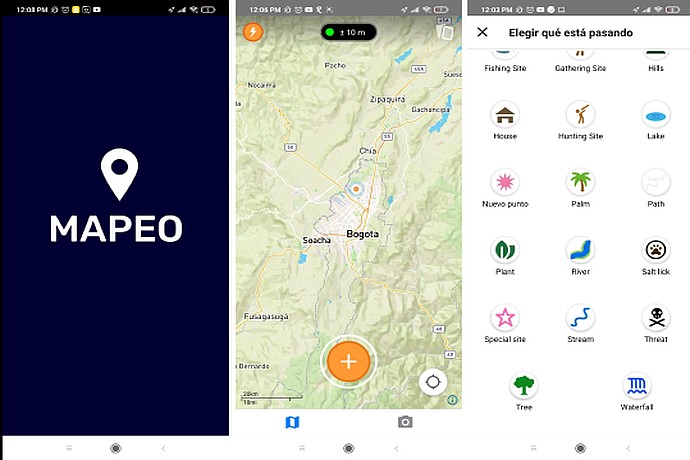
The image shows three screens of the Mapeo app: home with logo, map centered on Bogota, and registration options like "House", "Plant", "River" and more, for selecting events or places.
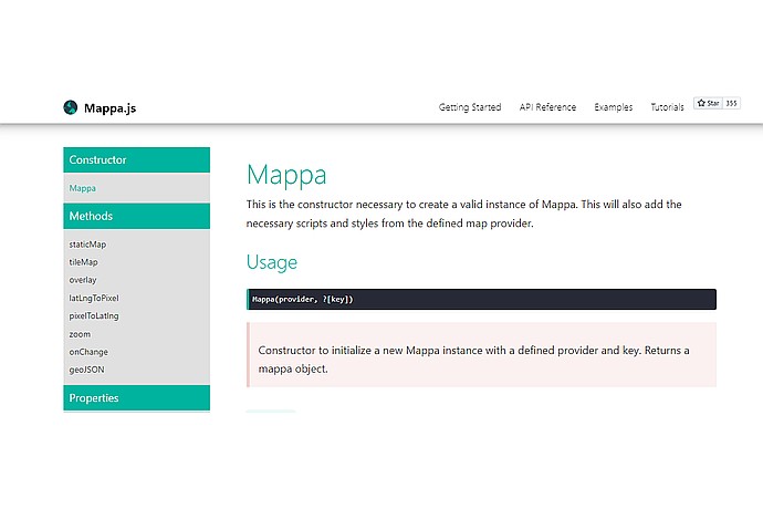
Mappa.js interface displays the "Mappa" constructor for creating instances. Includes methods like staticMap and tileMap. Usage: Mappa(provider, ?[key]), returns a mappa object. Accessible sidebar menu.
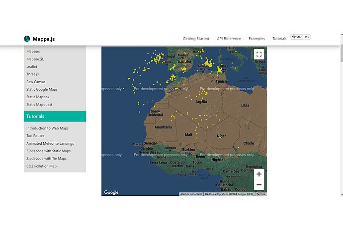
Interactive Mappa.js map showing meteorites as yellow dots over Northwest Africa and Europe. Includes tutorials on the left side; text "For development purposes only".
Free tool to document, monitor and map various types of data.
Information about tools developed by Digital Democracy, including Mapping.