
Language
Java
Tool Type
Web app, Mobile app
License
GNU Affero General Public License 3
Version
1.1.0
Codeando México

MapMap is an open source toolset that simplifies collaborative public transportation mapping, especially useful in small and medium-sized cities. It allows users without much technical knowledge to create and publish information about transportation infrastructure effectively and economically. This methodology supports governments and local communities in the analysis and planning of public transport, contributing to sustainable solutions and reducing polluting emissions, thus facing the urban challenges that arise from the rapid growth of cities.
MapMap solves the challenge of lack of accessible public transportation data, especially in small and medium-sized cities. It provides a low-cost, easy-to-use solution that allows governments and local communities to generate and share information about their transportation networks, facilitating urban planning and improving transportation infrastructure.
Utilizes a mobile app for real-time tracking and mapping of public transportation routes. The server application compiles and organizes data collected from the mobile app. Empowers users to contribute to the creation of a comprehensive public transport map. Improves accessibility to reliable information on public transit routes and schedules. Aims to enhance urban mobility by providing clear data to both users and city authorities.
Developed for Android mobile platforms, it optimizes accessibility. Incorporates real-time data collection and mapping technologies, ensuring dynamic information capture. Utilizes server-side applications for efficient data aggregation and management. Embraces an open-source nature, allowing continuous improvements by the community. Complies with licensing standards such as the MIT License and the GNU Affero General Public License v3.0, ensuring transparency and open collaboration.
Connect with the Development Code team and discover how our carefully curated open source tools can support your institution in Latin America and the Caribbean. Contact us to explore solutions, resolve implementation issues, share reuse successes or present a new tool. Write to [email protected]
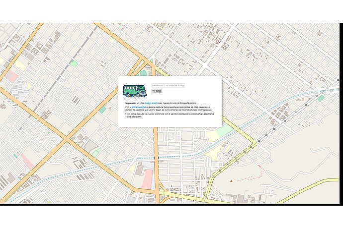
Street map featuring a "MapMap" box, an open-source tool for mapping public transport routes. It allows capturing georeferenced data of routes, passengers, and times.
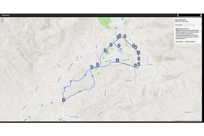
"MapMap" map shows route 10001 in Guanajuato, from Marlboro Bridge to Central Pozuelos, bypassing downtown. Includes points of interest and option to export CSV or Shapefile.
Article describing how MapMap was used to collect georeferenced data from public transportation routes in Xalapa, Veracruz, Mexico.
Non-profit organization that promotes the solution of citizen problems in Mexico through the use of technology.