
Language
C++
Tool Type
Web app
License
The MIT License
Version
0.11.5
MOTIS Project

MOTIS (Multi-Objective Travel Information System) is a comprehensive system for intermodal travel information. Provides real-time itineraries using a variety of transportation modes, including trains, buses, trams, and bike sharing. With capabilities to handle real-time changes to itineraries and dynamic visualization of vehicle movements, MOTIS is a crucial tool to optimize users' travel experience and improve route planning in cities.
MOTIS solves the problem of lack of integration and optimization in intermodal travel information, making it easier for users to plan and adjust their routes efficiently in real time, which is vital to improve mobility and reduce the stress of traveling in environments complex urban areas.
**Real-Time Transit Data Integration**: Aggregates data from various sources to provide real-time transit information. **Dynamic Route Optimization**: Offers optimal route planning based on current traffic conditions and transit schedules. **Scalable Architecture**: Designed to handle growing data volumes and complex urban transportation networks. **User Accessibility**: Provides an easy-to-use interface for commuters and transport authorities. **Predictive Analytics**: Utilizes advanced algorithms for traffic prediction and management. **Multi-Modal Transportation Support**: Supports various modes of transport, including buses, trains, and bikes. **Efficiency Analysis**: Offers tools for analyzing and improving transit system efficiency. **Environmental Impact Assessment**: Includes features to evaluate and reduce the environmental impact of transportation systems.
Utilizes modern programming languages, like Python or Java, for efficient backend development. Employs robust databases, using PostgreSQL for optimized data management. Incorporates RESTful APIs, ensuring seamless and hassle-free data integration. Implements advanced security protocols to protect data in transit. Leverages cloud infrastructure to ensure scalability and reliability. Ensures quality through automated testing frameworks and adopts responsive web design for enhanced accessibility. Complies with transportation standards,
Connect with the Development Code team and discover how our carefully curated open source tools can support your institution in Latin America and the Caribbean. Contact us to explore solutions, resolve implementation issues, share reuse successes or present a new tool. Write to [email protected]
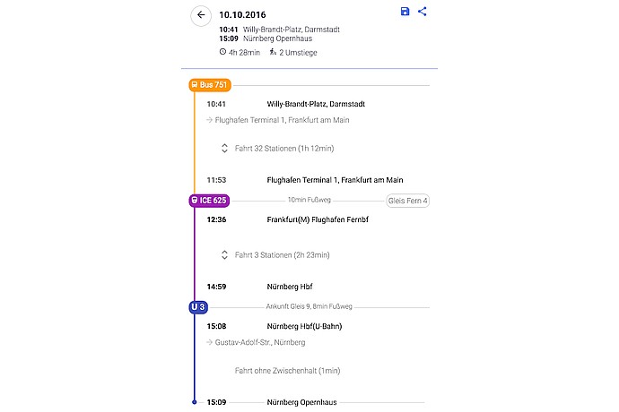
Travel on 10.10.2016 from Darmstadt to Nuremberg: Start at 10:41 from Willy-Brandt-Platz by bus, then ICE train at 12:36, U-Bahn connection; arrive at 15:09 at Nürnberg Opernhaus.
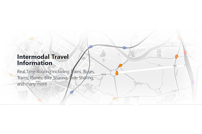
Map featuring travel routes and text: "Intermodal Travel Information. Real Time Routing including Trains, Buses, Trams, Planes, Bike Sharing, Ride Sharing, and more". Grey background with colored lines and dots.
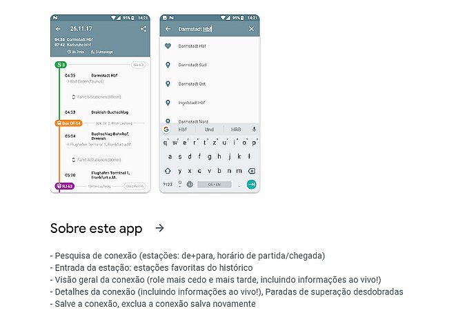
This image shows a mobile application interface for public transportation, with functions for connection search, station entry, overview of connections, and detailed stop information.
Intermodal travel information system that supports GTFS in real time, is open source and provides an HTTP JSON API, as well as web and Android applications.