
Language
Java
Tool Type
Desktop app, Mobile app, Web app, API
License
Apache License, Version 2.0
Version
2023.2.4
ODK
ODK is an open source platform that allows you to create and manage forms for data collection, providing robust tools for capturing and analyzing information anywhere. Developed to improve the efficiency and quality of data collection, ODK facilitates both online and offline operation, allowing users in the field to collect accurate and reliable data, and supporting evidence-based decision making.
ODK improves the accessibility and efficiency of data collection, allowing users in remote locations or with connectivity limitations to capture high-quality information, improving project management and decision making.
Enables creation of powerful forms including photos, GPS locations, and multiple languages. Operates both online and offline, syncing data when internet is available. Allows easy data analysis and integration with apps like Excel, Power BI, Python, or R. Suitable for diverse sectors like public health, crisis response, and environmental research. Utilizes an open-source framework, allowing customization and full control over data collection.
Implements Java and Python for robust and scalable backend development. Ensures accessibility by building on the Android platform for the mobile application. Incorporates XML for form design, allowing flexibility in data collection formats. Utilizes an open-source framework that facilitates customization and community-driven enhancements. Provides API access for custom integrations, compatible with popular programming languages for enhanced data manipulation.
Connect with the Development Code team and discover how our carefully curated open source tools can support your institution in Latin America and the Caribbean. Contact us to explore solutions, resolve implementation issues, share reuse successes or present a new tool. Write to [email protected]
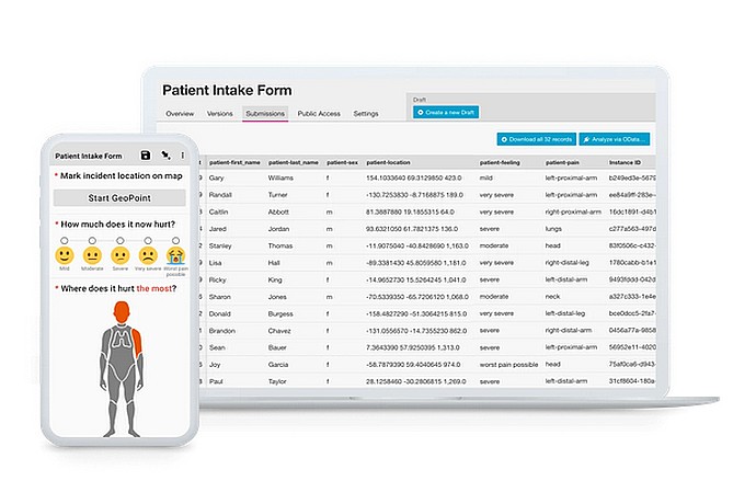
This image displays a patient intake form interface, showing a list of patients with details like location, pain severity, and affected body parts, indicating a medical data management system.
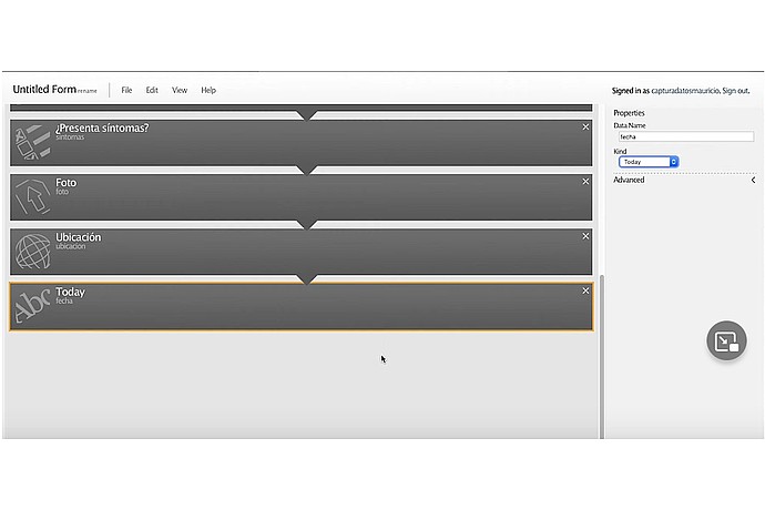
This image shows a user interface for a form builder application, with fields for symptom presence, photo, location, and date, likely for medical or health tracking purposes.
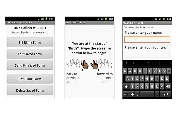
The image shows three screens from the ODK Collect 1.2 RC1 app. First: a menu with options like "Fill Blank Form". Second: swipe instructions. Third: a form to enter name and country.
Toolkit for data collection, management and use in resource-limited environments.
Official list of open source tools endorsed by the Digital Public Goods Alliance. This tool is part of this registry.
Article that presents the global alliance to promote digital public goods and its relationship with the IDB.