Language
Java, Javascript
Tool Type
Manual
License
The 3-Clause BSD License
Version
3.9.2003
OpenRefine

Open Refine is a powerful tool for working with messy data. It allows you to clean, transform, and enrich data sets using web services and external data, all from a browser and in the privacy of your computer. With features such as facets for exploring large volumes of data, clustering to correct inconsistencies, and reconciliation with external databases, Open Refine facilitates efficient information management. It also offers a history of operations with undo and redo options, ensuring complete control over your data.
OpenRefine solves the problem of working with messy data by offering a free and open-source tool that cleans, transforms, and enriches data. It facilitates the correction of inconsistencies and integration with external databases, improving the quality and usefulness of data for decision-making.
OpenRefine is an open source tool that allows you to load, understand, cleanse, reconcile, and enrich data from a web browser. It runs on your computer, guaranteeing privacy, and offers features such as faceting, clustering, and reconciliation to improve data quality and consistency.
OpenRefine uses open standards such as the JSON data format for data import and export, and the Data Reconciliation Protocol for connecting to external databases. Furthermore, its source code is available under the BSD license, promoting transparency and collaboration in its development.

Connect with the Development Code team and discover how our carefully curated open source tools can support your institution in Latin America and the Caribbean. Contact us to explore solutions, resolve implementation issues, share reuse successes or present a new tool. Write to [email protected]

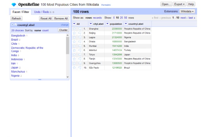
Displays a table of the 100 most populous cities and allows filtering by country using facets.

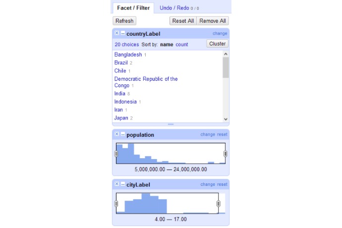
Interface for filtering data by country, population, or city name using facets and adjustable ranges.

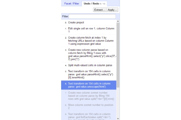
Displays the sequence of steps applied to the project, including text transformations and column creation.
What it is and what it is used for (use cases).
Uses in journalism and GLAM.
Complete guide to functions and flow.
Community news and articles.
