
Language
TypeScript, Javascript, Python, Shell, Docker, HTML
Tool Type
API
License
Apache License, Version 2.0
Version
N/D
HOT OSM

OpenAerialMap is an open platform that facilitates the hosting and access to aerial images obtained by satellites, unmanned aerial vehicles (UAVs) and other aircraft, especially useful in humanitarian response and disaster preparedness. OAM employs a number of open-source tools to process image metadata and create an accessible API, as well as allowing contributors to upload new data. This platform has evolved to become the benchmark in the sharing and access of openly licensed images, supporting humanitarian mappers to generate up-to-date geospatial data of unofficially mapped areas around the world.
OpenAerialMap solves the challenge of accessing and using post-disaster aerial imagery, which is often difficult to obtain and manage. By providing simple, unified access through its platform, it makes it easier for humanitarian organizations and image providers to share and use essential visual resources for emergency planning and response.
OpenAerialMap (OAM) operates as an open platform that facilitates access and sharing of aerial imagery for humanitarian response and disaster preparedness. It uses open-source tools to process image metadata and enable the upload of new data, ensuring that the imagery is globally accessible and usable.
OpenAerialMap adopts the STAC (SpatioTemporal Asset Catalog) API to index image collections and distributes GeoTIFF mosaics and TMS/XYZ tiles. STAC, published by OGC, enables unified searches, JSON metadata, and full interoperability with GIS viewers, avoiding proprietary schemas in collaborative aerial mapping.
Connect with the Development Code team and discover how our carefully curated open source tools can support your institution in Latin America and the Caribbean. Contact us to explore solutions, resolve implementation issues, share reuse successes or present a new tool. Write to [email protected]
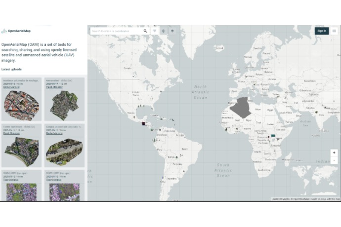
OpenAerialMap view showing recent aerial uploads and their location on the world map.
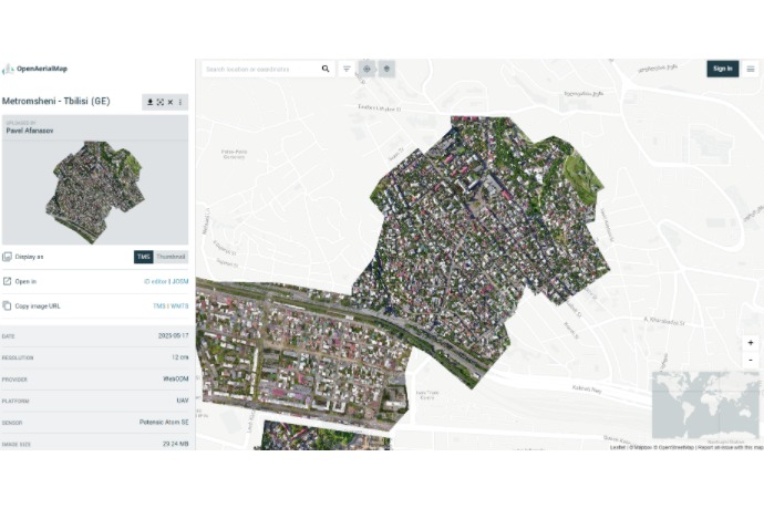
Detailed aerial capture of Metromsheni district in Tbilisi from UAV, published on May 17, 2025.

Aerial image captured by UAV in Gladstone on March 28, 2023, showing a residential neighborhood in high detail.
Visit the first Security and Justice Evidence Bank available in Spanish and Portuguese, with systematized evidence of nearly 100 types of solutions and 700 cases evaluated to prevent crime and violence.