
Language
TypeScript
Tool Type
Mobile app
License
GNU General Public License version 3
Version
1.0.0
OpenTrace
OpenTrace uses the BlueTrace protocol for community contact tracing, preserving privacy through Bluetooth devices and enabling global interoperability. This system facilitates decentralized proximity registration and complements centralized tracking by health authorities. It improves the scalability and efficiency of contact tracing, overcoming the limitations of manual tracing that relies on personal memory. BlueTrace frequently changes temporary device identifiers to prevent malicious tracking and collects minimal personal information, thus ensuring user privacy under their consent.
OpenTrace improves the efficiency and scalability of traditional contact tracing that relies on people's memory and acquaintances, providing a solution that respects privacy and uses fewer resources, making contact tracing more adaptable at large scales.
The functionalities of BlueTrace include: 1. User Registration and UserID Assignment: Users register with their phone number, and a unique UserID is generated. 2. TempID Generation: Temporary IDs (TempIDs) are created to maintain user privacy during encounters. 3. Bluetooth Low Energy (BLE) Handshake Flow: Devices exchange messages using BLE for proximity detection. 4. Encounter Messages: These messages are exchanged when devices come into proximity, containing TempIDs. 5. Storage of Encounter History: Each device stores its encounter history locally, which can be used for contact tracing. 6. Data Analysis Flow: Analysis of the encounter data for contact tracing. 7. Withdrawal of Consent: Users can withdraw consent, leading to the deletion of their data.
Supports hybrid contact tracing models, decentralized or centralized. Uses AES-256-GCM encryption, encoded JSON messages, and protects user privacy.
Connect with the Development Code team and discover how our carefully curated open source tools can support your institution in Latin America and the Caribbean. Contact us to explore solutions, resolve implementation issues, share reuse successes or present a new tool. Write to [email protected]
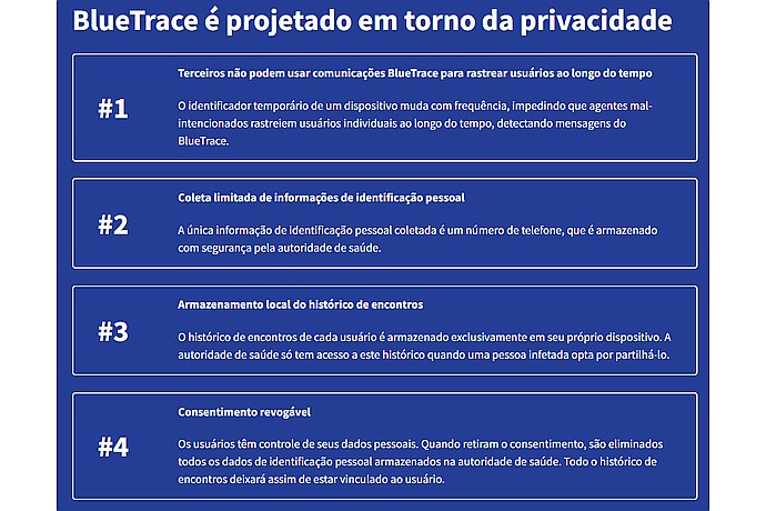
This image outlines the privacy design principles of BlueTrace, a protocol for digital contact tracing, emphasizing temporary IDs, limited personal data collection, local data storage, and revocable consent.
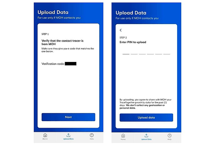
This image displays two steps from a mobile application for uploading data to the Ministry of Health (MOH), including verification code entry and PIN submission for data upload.
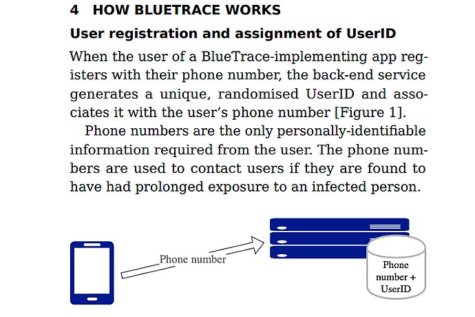
This image explains the user registration and UserID assignment process for the BlueTrace contact-tracing system, highlighting phone number linkage to a unique UserID.
Open source digital contact tracing system based on Bluetooth Low Energy, created by GovTech Singapore in March 2020.