Language
PHP
Tool Type
Web app
License
GNU General Public License version 3
Version
3.08
Poblaciones

Poblaciones is a platform that facilitates the creation of collaborative spaces for the management of spatial data. It allows users to upload and georeference datasets in various formats, build indicators, and share or work privately with the information. Designed to be accessible, it requires minimal software and hardware requirements, thanks to its architecture based on standard technologies. Developed by the Argentine Social Debt Observatory and CONICET, Poblaciones seeks to democratize access to public information and promote open science. It offers a platform for the visualization and analysis of social data, promoting collaboration between researchers and facilitating decision-making in public policies. Its collaborative approach invites it to expand its use in Latin America and the Caribbean, benefiting governments, NGOs and civil society.
Populations solves the problem of access and management of spatial data, allowing the creation of collaborative spaces to upload, georeference and analyze datasets. It facilitates the democratization of public information and promotes open science, supporting decision-making in public policies and collaboration between researchers.
Web application for spatial data publication. Collaborative environment for data sharing. Focuses on population-related geospatial information.
Application developed primarily in PHP and C#, using open-source technologies. Distributed under the GPL-3.0 license, it promotes software transparency and reuse.
Connect with the Development Code team and discover how our carefully curated open source tools can support your institution in Latin America and the Caribbean. Contact us to explore solutions, resolve implementation issues, share reuse successes or present a new tool. Write to [email protected]
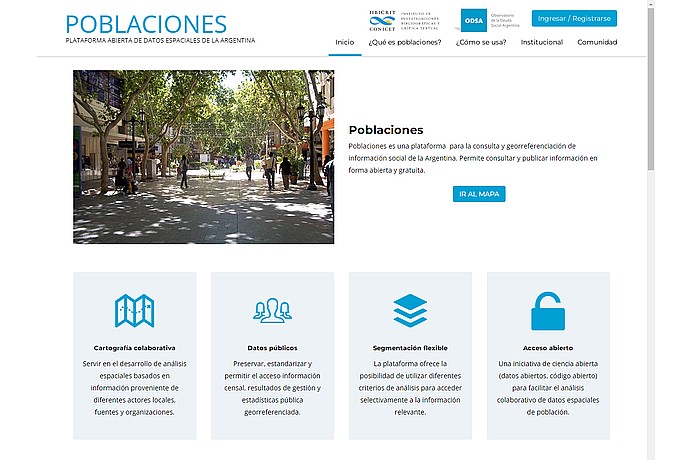
"Website "Populations", a spatial data platform from Argentina with collaborative mapping and public data. Offers flexible segmentation and open access. Button: "Go to map"."
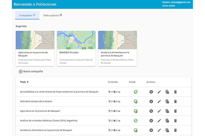
"Populations" home screen with suggested maps: Agriculture in Neuquén, ENMODO Posadas, Food Assistance. List of maps with titles, content, status, and actions. User: [email protected].
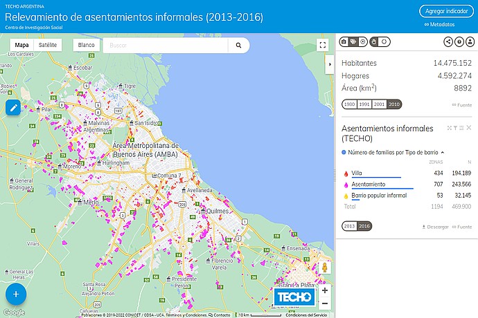
Map of informal settlements in AMBA, Argentina (2013-2016) by TECHO. Shows 1,194 settlements with 469,900 families. Types: villa (434), settlement (707), popular neighborhood (53).
Open platform for the consultation and georeferencing of social information in Argentina, allowing users to publish and share spatial data.
Description of how the platform allows you to build virtual maps using public data from Argentina.