
Language
TypeScript
Tool Type
Web app, Manual
License
The MIT License
Version
N/D
World Food Programme (WFP) – VAM Unit (Vulnerability Analysis & Mapping)
PRISM is the World Food Programme (WFP) project front-end interface that allows you to visualize data and impact projections on a configurable map. It facilitates the upload of administrative data and the visualization of geospatial layers, offering a useful tool for decision-making in humanitarian contexts. The tool allows you to upload administrative boundaries and vector data, as well as display WMS layers and CSV tables. Its flexible configuration allows you to customize the visualization according to the country and specific needs, making it a valuable resource for public officials and organizations in Latin America and the Caribbean.
WFP PRISM Frontend solves the problem of visualizing complex data and impact projections on a configurable map, making it easier for public officials and organizations to make informed decisions about food security and risk management in Latin America and the Caribbean.
WFP PRISM Frontend is a web interface that allows you to visualize data and impact projections on a configurable map. It loads administrative boundaries and vector data, displays WMS layers and points with symbology, and presents CSV tables. The tool is adaptable to different countries using environment variables.
The PRISM Frontend tool uses open standards such as GeoJSON for uploading administrative boundaries and JSON for vector data. It also supports WMS layers from Geoserver or Open Data Cube, allowing for date selection. These standards facilitate interoperability and access to geospatial data across government platforms and organizations.
Connect with the Development Code team and discover how our carefully curated open source tools can support your institution in Latin America and the Caribbean. Contact us to explore solutions, resolve implementation issues, share reuse successes or present a new tool. Write to [email protected]
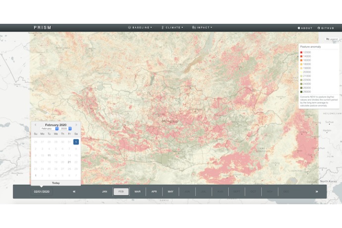
Interactive map showing pasture anomalies in Mongolia, February 2020, useful for climate monitoring and response planning.
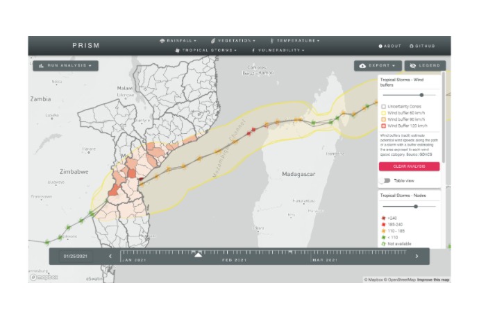
PRISM interactive map showing the track of a tropical cyclone and wind speed impact zones over Mozambique.
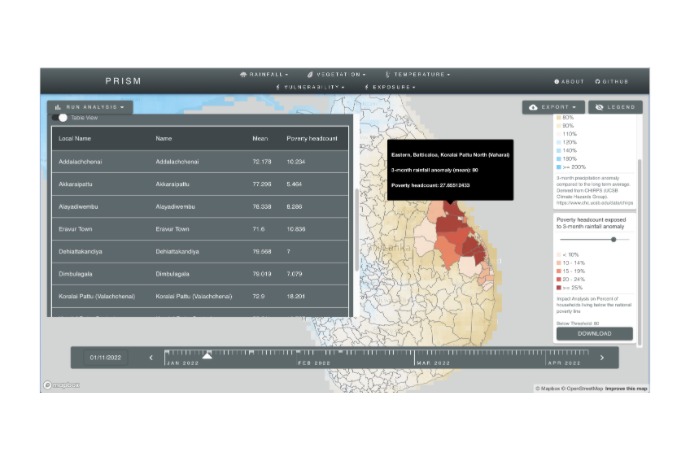
The map shows a 3-month precipitation anomaly overlaid with regional poverty levels in Sri Lanka, alongside a summary table.
Official list of open source tools endorsed by the Digital Public Goods Alliance. This tool is part of this registry.
Article presenting the global alliance to promote digital public goods and its relationship with the IDB.