
Language
Python
Tool Type
Plugin
License
AM331-A3
Version
1.0.0
Inter-American Development Bank

SaniHUB Ramales is a software designed to facilitate the design and planning of domestic sewer connections. It offers tools to create condominium and conventional type systems, using field data collected with Qfield and processed in QGIS. This tool focuses on the geolocation and management of services in the water, sanitation and solid waste sector. It allows the collection, analysis and visualization of data, optimizing the development of sanitary infrastructure projects.
SaniHUB addresses the lack of accessible and effective tools for designing sewer systems in resource-limited communities, facilitating the expansion of essential health infrastructure and improving public health conditions.
Allows project design using field data collected through Qfield. Supports both condominium and conventional sewer systems. Allows import and export of data for seamless project management. Facilitates the calculation and generation of work orders for construction.
Built under the GNU GPLv3 license, it ensures transparency and continuous collaboration. Integrates with QGIS to facilitate project design and management, promoting interoperability. Utilizes Qfield for efficient mobile data collection in the field. Allows exporting projects in .xls format, ensuring smooth and collaborative information exchange.
Connect with the Development Code team and discover how our carefully curated open source tools can support your institution in Latin America and the Caribbean. Contact us to explore solutions, resolve implementation issues, share reuse successes or present a new tool. Write to [email protected]
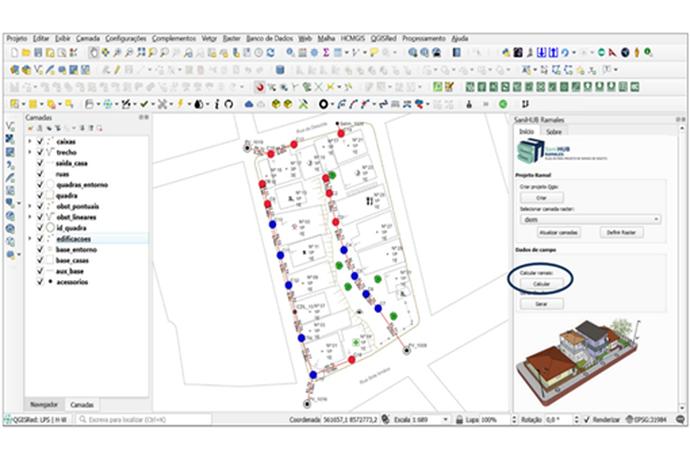
This image displays a screenshot of a Geographic Information System (GIS) software with a detailed urban map. There are colored symbols and lines indicating various features or data, such as roadways and buildings, and a smaller window showing a 3D model of a building.
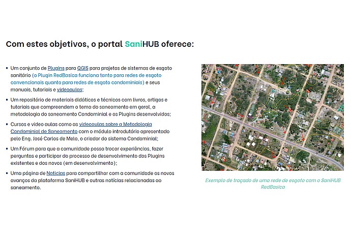
This image displays a segment of an informational website about the SaniHUB portal. It details the resources provided: QGIS plugins, educational materials, courses, discussion forums, and a news page. To the right, there is an example of sewage network mapping using SaniHUB RedBasica.
Digital repository that promotes open technologies for water, hygiene and sanitation services.
Presentation of the tool and its functionalities in healthcare design with QGIS.
Technical Cooperation to promote a new sanitation paradigm in Latin America and the Caribbean.
Series of educational videos that explain the use of SaniHUB Branches for the design of home sewer connections.