
Language
Javascript
Tool Type
Web app
License
The 2-Clause BSD License
Version
4.6.1
HOT OSM

Tasking Manager is the leading tool for coordinating mapping in OpenStreetMap. It allows you to define areas of interest and subdivide them into manageable tasks, facilitating quick and organized mapping. Indicates which areas need to be mapped or reviewed to ensure quality. Initially developed by and for the OpenStreetMap Humanitarian Team, Tasking Manager is now widely used by various communities and organizations. It is shared to optimize collaborative mapping efforts, ensuring accurate and efficient work across multiple projects.
Tasking Manager solves the challenge of coordinating large volumes of work in collaborative mapping. Ensures the efficiency and quality of mapping in OpenStreetMap, facilitating the subdivision and review of tasks in specific areas.
Area division for focused mapping tasks. Collaboration tools for team mapping. Quality assurance features. Real-time progress tracking.
Integrates JavaScript and Python to enhance system functionality and flexibility. Utilizes Flask as a web development framework to facilitate scalable application creation. Implements Reactjs to offer a dynamic and responsive user interface. Employs PostgreSQL along with PostGIS to efficiently manage and analyze spatial data. Adopts the BSD-2 Clause license to encourage open contribution and collaboration within the open-source community.
Connect with the Development Code team and discover how our carefully curated open source tools can support your institution in Latin America and the Caribbean. Contact us to explore solutions, resolve implementation issues, share reuse successes or present a new tool. Write to [email protected]
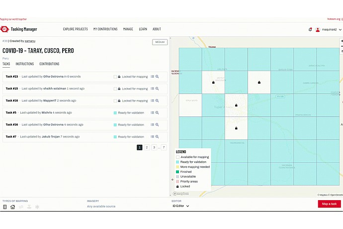
"Tasking Manager" screen with tasks to map COVID-19 in Taray, Cusco, Peru. Various map squares are ready for validation, others are locked or available for mapping.
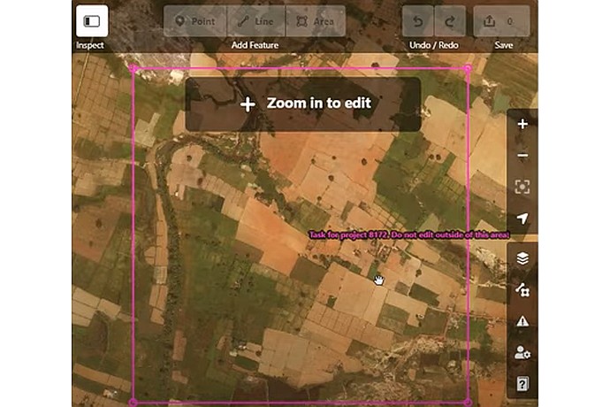
Satellite image of a rural area divided into multi-colored agricultural plots. A pink box outlines the editing zone. Overlay text: "Task for project 81172". Visible editing icons.
This image shows an aerial view of a landscape with delineated boundaries, possibly for a mapping task to identify or mark features such as roads or buildings.
Platform to coordinate collaborative mapping tasks in OpenStreetMap.
Manual to configure and manage projects in Tasking Manager.
Step-by-step instructions for contributing to mapping projects.