
Language
Javascript
Tool Type
Desktop app
License
The MIT License
Version
1.4.2
food4Rhino

Urban IO is an open source modeling and simulation tool for Rhinoceros and Grasshopper, designed to facilitate urban design through the manipulation and analysis of geospatial and urban data. Used to optimize urban design stages, Urbano IO allows from the download and integration of data to the generation of innovative and sustainable urban designs, supporting the creation of effective solutions in urban planning.
Urban IO facilitates the integration and analysis of data in urban design, improving the planning and execution of urban projects through advanced and accessible modeling tools.
Download Geospatial data: Download maps and points of interest data from OpenStreetMaps directly in Grasshopper. Import and aggregate data: Parser and import layers of existing state information easily from OSM or shapefiles Lookup and modify metadata: Attach metadata to the geometric data that can be looked up, modified, and customized parametrically. Preprocess and build mobility model: Automate mobility modeling steps including creating topological street network and generating each building's access point to streets. Routing in different modes: Find routes between origin and destination buildings using different transit modes such as pedestrian or car. Simulate with trip engine: Run active mobility simulation for specific buildings using Trip Engine with the given Amenity Demand Profile (ADP) and trio-sending mode. Analyze amenities and streets: Compute various metrics in urban analysis including Streetscore, AmenityScore. and Walkscore. Integrated cad workflow: Bake model geometry with metadata to Rhino. Work seamlessly with other visualization components.
Implements version control using a Git repository, ensuring standard practices for collaborative software development. Integrates Grasshopper for visual programming, offering customization in urban design. Incorporates plugin files for Rhino, enabling advanced 3D modeling capabilities. Utilizes OpenStreetMap data to import and process geospatial information. Adopts a standard Windows installation process with .msi packages, facilitating software deployment.
Connect with the Development Code team and discover how our carefully curated open source tools can support your institution in Latin America and the Caribbean. Contact us to explore solutions, resolve implementation issues, share reuse successes or present a new tool. Write to [email protected]
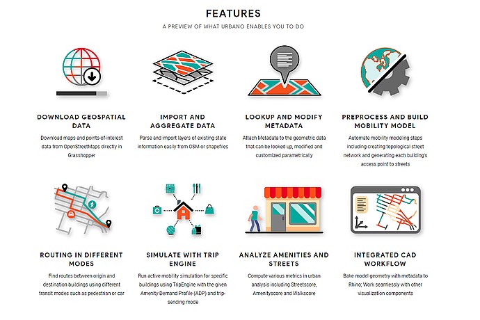
This image outlines the features of Urbano IO', a tool for urban data analysis, including geospatial data download, data aggregation, metadata modification, and mobility model preprocessing.
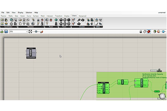
This image shows a screenshot of a graphical programming interface, possibly from a software like Grasshopper for Rhino, which is used for algorithmic modeling and data analysis.
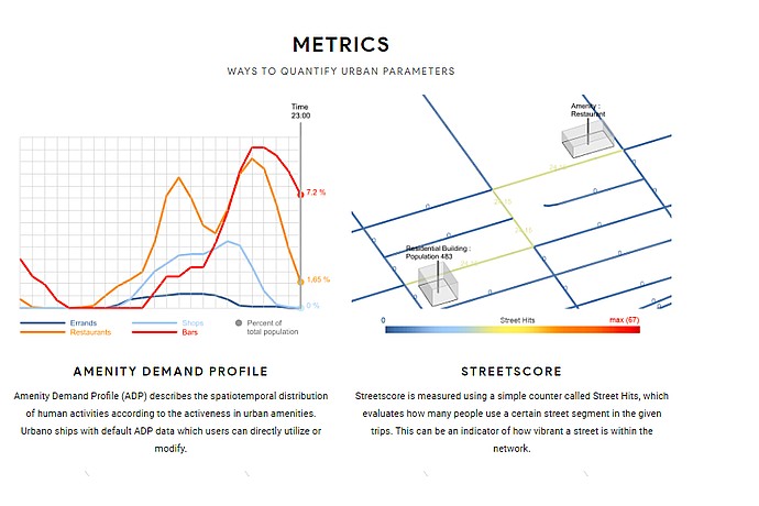
This image depicts two urban analysis metrics: "Amenity Demand Profile" graph showing activity over time, and "Streetscore" map indicating street usage intensity.
Tool for modeling and simulation of urban spaces in Rhinoceros and Grasshopper.