
Language
PHP
Tool Type
Web app
License
GNU General Public License version 3
Version
1.0.0
Ushahidi

Ushahidi is a crowdsourcing and mapping platform that helps communities turn information into action. It facilitates the collection, management and analysis of crowdsourced data, allowing individuals and groups to create meaningful change. Ushahidi has been crucial in contexts of natural disasters, public health, elections and corruption surveillance, providing a means to document and respond to critical events and promote transparency and community activism.
Ushahidi faces the challenge of collecting and effectively using community information to promote social and political change, offering a tool that allows communities to manage large volumes of data and generate effective responses in situations of crisis or need for government transparency.
Data Aggregation: Collects data from SMS, emails, tweets, and other sources for analysis. Mapping and Visualization: Presents collected data on interactive maps for easy understanding and analysis. Survey Creation: Allows users to create and configure surveys for data collection. Categorization of Data: Organizes data into categories for more effective analysis and reporting. Geolocation of Information: Geolocates incoming data to visualize it on the map.
Built as an open-source platform, it allows community contributions and modifications. Utilizes a REST API for backend operations, facilitating data management and retrieval. Leverages Docker to simplify backend deployment and scaling. Integrates multiple data sources, including social media, SMS, and email. Provides comprehensive documentation for users and developers, aiding in setup and customization.
Connect with the Development Code team and discover how our carefully curated open source tools can support your institution in Latin America and the Caribbean. Contact us to explore solutions, resolve implementation issues, share reuse successes or present a new tool. Write to [email protected]
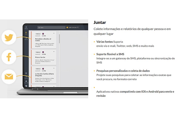
Screenshot of Ushahidi showing a panel collecting info from various sources like Twitter, Facebook, and email. It offers flexible SMS support and apps for iOS and Android.
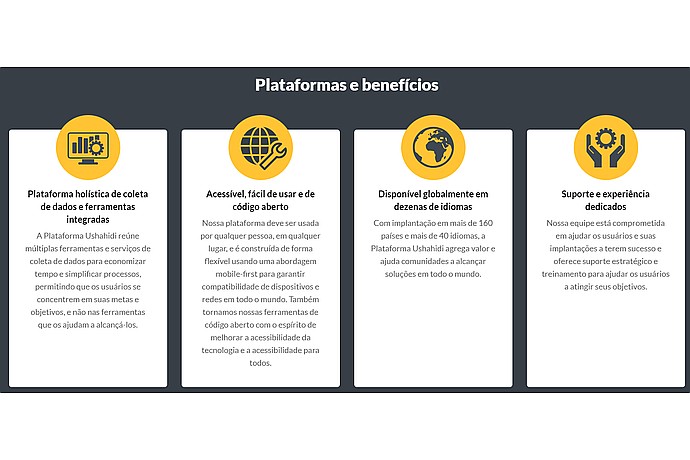
This image displays information about a data collection and tool integration platform, emphasizing its holistic approach, accessibility, global availability in multiple languages, and dedicated support.
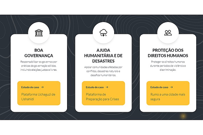
This image presents three core values or focus areas: Good Governance, Humanitarian Aid and Disaster Assistance, and Protection of Human Rights, with associated case studies and platforms.
Platform that allows the collection, management and analysis of information from multiple sources, facilitating the creation of interactive maps to visualize data.
Official list of open source tools endorsed by the Digital Public Goods Alliance. This tool is part of this registry.
Article that presents the global alliance to promote digital public goods and its relationship with the IDB.