
Language
Python
Tool Type
Algorithm, API
License
AM331-A3
Version
1.1
Inter-American Development Bank

VIAsegura is a set of advanced models designed to improve road safety by detecting critical elements such as delineation, lighting and the number of channels on the roads. Using software in Python, it facilitates integration into platforms capable of executing code in this language, offering 16 models aligned with global road safety standards. Given the alarming figure of 1.35 million annual deaths due to traffic accidents, VIAsegura emerges as a strategic solution for the countries of Latin America and the Caribbean. By automating the detection of road safety problems, this tool promises to optimize the investment of resources, allowing governments to redirect funds towards the effective correction of said problems and, therefore, improve safety on the region's roads.
Víasegura addresses the challenges associated with road safety and transportation planning, including identifying high-risk areas and analyzing traffic-related data. Empowers users to make informed decisions to reduce accidents and improve road infrastructure.
Traffic Analysis: The platform offers tools for analyzing traffic data, including traffic volume, speed, and accident history. Risk Assessment: Users can assess and identify high-risk areas for traffic accidents and prioritize safety improvements. Visualization: Víasegura provides data visualization features to create maps and reports that help communicate traffic and safety findings effectively. Scenario Modeling: Users can model different transportation scenarios to evaluate the impact of road safety interventions. Customization: The tool is customizable to align with the specific traffic analysis and road safety assessment needs of different cities and regions. Documentation: Comprehensive documentation available on the platform's website assists users in effectively utilizing traffic analysis and risk assessment features.
Built with Python: leverages its flexibility and efficiency. Integrates TensorFlow for advanced image recognition model execution. Employs classification techniques to identify urban features such as road lines and pavement conditions. Facilitates installation via pip, allowing easy model downloads through specific commands. Optimizes processing by utilizing GPU, ensuring enhanced performance.
Connect with the Development Code team and discover how our carefully curated open source tools can support your institution in Latin America and the Caribbean. Contact us to explore solutions, resolve implementation issues, share reuse successes or present a new tool. Write to [email protected]
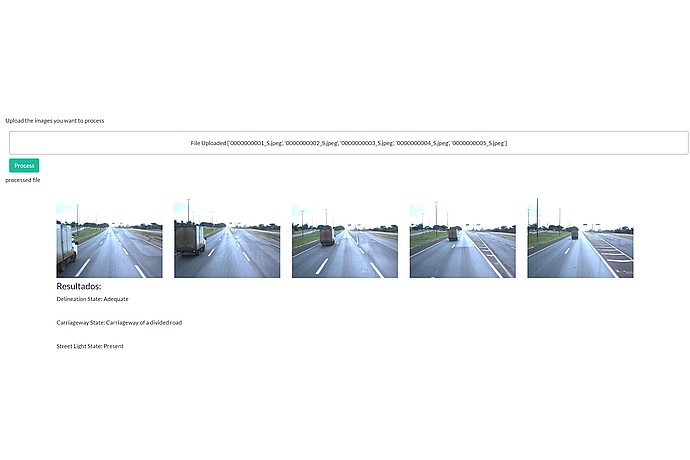
A digital tool named "Safeway" displays five images of a divided road. Results: Proper delineation, divided roadway, lighting present. Files: '0000000001_S.jpeg' to '0000000005_S.jpeg'.
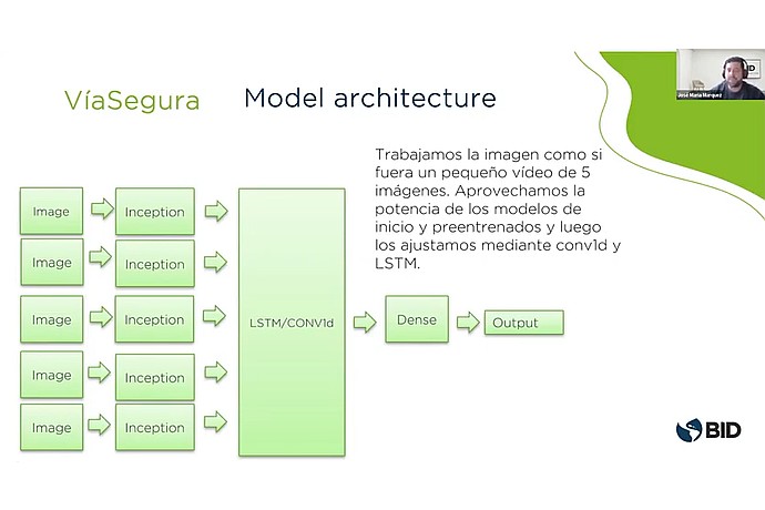
"ViaSegura" architecture model: Processes 5 images with Inception, followed by LSTM/Conv1D. Then a Dense layer and Output. Text: Tuned with pre-trained models. BID logo.
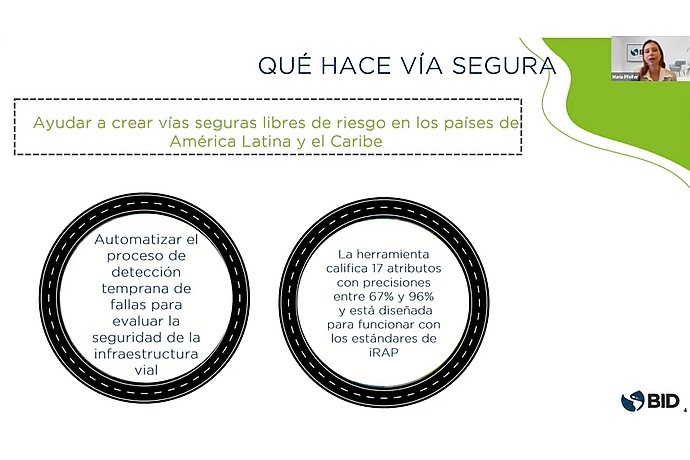
Víasegura helps create safe roads in Latin America and the Caribbean, automating fault detection in road infrastructure and rating 17 attributes by iRAP standards.
Analysis of the impact and use of VíaSegura in Latin America and the Caribbean.
Code4Dev Webinar: Learn how to implement the Víasegura tool
Technical Cooperation to transform transportation planning in LAC through Big Data and AI.
It details how VíaSegura uses AI to evaluate and improve safety in road infrastructure.